Showing posts with label Klamath Falls. Show all posts

Saturday, September 22, 2012

DAY 31-32- Bike Ride, Museum, & Family...

DAY 31- A Bike Ride and Logging Museum...

Photo- Bike path in Klamath Falls near where bike paths meet.
It was beautiful blue skies with not a cloud in the sky and the temp had risen to mid-50’s; as I jumped on my bike to explore the Klamath Falls area a second time.  I will say that Oregon in general is a very bike friendly state.  I was finding that the area of Klamath Falls was holding true to that rule too.

Klamath Falls has 2 main paved bike paths; one that goes along the city’s canal for about 6 miles and another that goes through the heart of the city and out to a small town called Olene.  The 2 paths meet at a bridge where they form an “X” and they make quite a bit of the city accessible via these paths.  There are sidewalks from various neighborhoods that meet up to the path and there are even other short paths that go into other parks or neighborhoods.  All of these path ways are reclaimed areas where the railroad used to be.  There are even additional unpaved trails that spread out from these two paths and if you had something other than a road bike, like me, you could go for miles and miles on this system of trails and paths.    
Photo- The Amtrak Station in Klamath Falls.
There are also quite a few street areas that have painted bike lanes in them too.  While trying to find where the second path started, I happened upon the Klamath Falls Amtrak Station.  I thought that was rather interesting that there was a station here.  But I guess there is a fair amount of tourist business that goes to nearby Crater Lake and commuters from the surrounding areas that use the train.
Photo- A big yard with a big garden along bike path.
Photo- A duck in the canal along bike path.

As I rode along both of these paths, I noticed all kinds of things.  There are a mix of big yards with gardens, ducks on the canal, schools, city swimming pools, farms, warehouses, RV resorts, lumber yards, nice neighborhoods and not so nice neighborhoods.  You almost felt like you were in the country in some areas even though you were only a ½ block away.
Later on, I went to the Collier State Park Logging Museum.  It’s about 40 miles north of Klamath Falls on Hwy 97. (Crater Lake’s south entrance is about 65 miles north of Klamath Falls.)  This museum is more of an outdoor display than the typical standard museum.  During the height of the summer they have state park employees that do demonstrations and give more guided tours of the area.  Well, as per my luck, I was two weeks late for all of that.  So I opted to borrow a map from the state park employee who was manning the information/gift shop and do my own self-guided tour.
Photo- Used to be drawn by horses and used to transport logs down the mountainside.
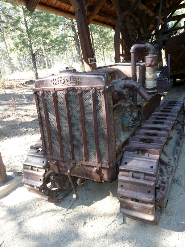
Photo- One of the first Caterpillars.
Photo- AND the $64,000 question is.... What's a RIP SNORTER?

The museum is set up with the history of logging in Oregon which started in the late 1860’s.  Logging in the late 1860’s consisted of hand tools and wagon-like vehicles where horses were used.  There were all kinds of examples of these items outside under pavilions.  Then, near the turn of the century steam came into being and steam-powered engine orientated machinery came into use.  These pieces of machinery were larger and were generally sitting out in the open.  Next, it was the combustible engine and the logging industry progressed on into our current time.  Most of these pieces were out in the open and on display. 
Photo- A restored original cabin of what the first loggers would have lived in.
There was also a cabin village area to show how most of the men would live while they were logging.  Most of these cabins were one room, with dirt floors, and hew from logs.  They were generally about 10’ x 14’ with a slanted roof.  It was a very interesting place to visit and it was just a very pretty day out.  It was nice just to be out enjoying it.

DAY 32—A Day Off and Family…
I know, I know… I had just taken off another day off just a few days ago and come on it can’t be that hard to be on a basically permanent vacation.  What’s up with that??!?  Well, I did need to catch up with some laundry, try to rearrange the inside of my car, and I wanted to do a bit of painting too; plus, I wanted to hang out some more with my Aunt Lindy too.   I managed to get a couple of paintings done and laundry got done too.  I hung out the whole day with Aunt Lindy and that was nice too.  It was a productive day. 
Photo- "Tickled Pink Shoppe"; Watercolor on 9" x 12" paper.
Based on shop I photoed in Portownsend, WA.
But let me say one thing about family; I think that there are more characteristics than just hair color, eye color, and general appearance that get passed on in a family.  What I’m alluding to is that I am now convinced that the genetic makeup for the open-mouth-insert-foot disease definitely runs in my family. Not that that’s bad but I noticed my family has a tendency to speak our minds and sometimes it’s not the most “Politically Correct” way of stating things.  I guess you could say that it’s probably a good thing that no one in the family is into running for political office because they would definitely be up that creek with no paddle and a ten foot wave coming at them.  But I will say that this same “disease” is part of the reason that makes me so dearly love my family too.  Sometimes, I think that it’s the small idiosyncrasies that make people, relationships and families so interesting; and thus, makes life very interesting too.  

Thursday, September 20, 2012

DAY 30 -Rogue-Umpqua Scenic Byway…

I planned on a scenic drive through central southern Oregon for the day.  Grant, Kimmie’s partner, had mentioned a nice route to drive but that it would take a whole day.  So I started out early; skipping breakfast and heading north out of Klamath Falls.  I passed by the Upper Klamath Lake and all of the pelicans.  I took Hwy 140 west after Rocky Point and went past Lake of the Woods and Fish Lake off into new Oregon territory for me.


Photo- Pelicans on the Upper Klamath Lake.

Shortly after passing Fish Lake, I took a right turn on to County Rd #821 on my way to Butte Falls.  I was driving through wonderful scenic forestland.  The road got rather curvy and I started to slow for the turns.  Before I knew it I was coming around a corner and BOOM!  There are cows in the middle of the road! COWS?!?!  Yes, I was in the middle of an open range area which happens quite a bit in Oregon but this was the first time I had actually seen cows on the road.  There were 7 large Black Angus cows in the middle of the road.  I slowed to a stop. 
Photo- HOLY COW!  They're in the road!

The cows just stood in the middle of the road.  HELLO! Move you big animals!  The car that was behind me started to honk and I followed suit; me being a City Girl had no idea what to do with cows in the middle of the road.  Low and behold; they started to move off the road.  Yeah!  As I drove by the cows just stared blankly at me.  I never realized how dumb cows could be.

I drove through the town of Butte Falls and after that the forestland was set back and fenced farms with green fields took up the foreground.  It was very pretty with horses and cows in the fields; with the periodic red barn or unpainted barn here and there. 
Photo- Farms with forest land in the background. Wonderful scenery!

I continued on; thinking that I was still on County Rd #821 but turns out I wasn’t.  I ended up coming out to Hwy 62 about 5 miles south of a cute small town called Shady Cove.  It was 15 miles south west of where I should have come out on Hwy 62.  But that was okay.  I went through Shady Cove where the cop sat right by the quickly reduced speed limit for the town.  I practically slammed on my brakes; to go from 55mph to 30mph.  I even managed a quick smile and way to the cop as I slowly went by.  But I HAD to stop for a quick picture of the pink Phil’s Frosty.  I later found out that it’s the place in Shady Cove to stop and eat ice cream or burgers.  There did seem to be a great deal of cars out front and it wasn’t even 11AM.
Photo- A hot spot and VERY pink place in Shady Cove!
Photo- The Rogue River as seen from a city park just north of Shady Cove.

I went along Hwy 62 where off to the right I could see the Rogue River.  It was a very scenic area with trees starting to change along the river and exposed rocks next to the road.  I drove past the small town of Prospect and on to Union Creek where I was told to definitely stop at Beckie’s Restaurant.  It was either their cinnamon roll or a piece of one of their pies that came highly recommended.  I stopped and I still had about 15 minutes of breakfast being served. 
Photo- A bird just taking off I saw on the Rogue River.
 
Photo- A MUST stop for thier cinnamon rolls or pie!
Photo- The inside of Beckie's Restaurant.

I opted for the yummy cinnamon French toast and hot coffee.  OMG!  It was dessert for breakfast!  It was as I was enjoying my breakfast that I over heard what sounded like Germans trying to learn to pronounce English words.  It was rather interesting listening.  As I was finishing my breakfast and looking at a map that I discovered I was close to a couple of sightseeing view sights.  I figured I could definitely use a bit of hiking to work off breakfast. 
Photo- Natural Bridge- where Rogue River runs under these lava rocks for 200ft. and then comes out.
Photo- Water comes out of Natural Bridge and there are side lava caves.

I did a bit of back tracking and went to the Natural Bridge parking lot.  The Natural Bridge is along the Rogue River and it’s where the river runs in lava tubes for about 200ft.  I grabbed my camera and off I went for the ¾ mile hike where there are viewpoints all along to see the Natural Bridge.  I read about the temperature of the water and how many gallons per minute that went through the Natural Bridge.  It was amazing and you could just hear the roar of the water as it went through the area.
Photo- Rogue River Gorge.

Next, I went by Beckie’s and discovered that while having breakfast I was about ½ block from a view overlook of the Rogue River Gorge.  I grabbed my camera again and off I went down the path.  This path however was packed with senior citizens.  It was a tour bus.  So I tried to slowly work my way through the group to where I could overlook the gorge area too. 

While trying to do that, the tour guide started talking to me.  He talked about how Oregon’s sportsmen’s, being so sports challenging orientated, used to canoe through this gorge area until about 2 years ago the state had to outlaw it.  He never heard of anyone dying doing it but he pointed out that it was seriously dangerous and he could imagine that some of they did die attempting it.  Why he shared that with me?  I’m unsure why he chose to share that information with me and he kept his voice down when he told me about it; so that none of the seniors could hear about it.  Strange.

Rather than turning east when Hwy 62 turned, I decided to continue on Hwy 230 up to Diamond Lake; a lake that I could see when I was on the trolley tour up at Crater Lake.  Yes, I was just west of Crater Lake and heading north.  I thought I want to see that lake from the shoreline.

I was about 6 miles north of there when I saw a sign that said—National Creek Falls with an arrow.  On the spur of the moment, I thought why not.  I turned the car.  I went down the road 3 miles to a sign with another arrow.  It said 2.5 miles on a one lane road with turn outs.  Okay, I thought I came this far.  I drove on the one lane road and only had a pickup truck that I had to wait for in a turnout.  I got to the next sign that pointed me off to the right to a parking area and another sign that had an arrow and said ½ mile hike.  I came this far and hoped it was really an actual waterfall but I continued on. 

Down the dirt path I went.  It hairpin turned down the side of a hill quickly and seemed to go back and forth again, and again, and again down the hill.  Wait a minute; this has got to be more than ½ mile by now.  BUT I continued on the path.  I got to the bottom and saw a couple with three dogs.    I went over a couple of logs and off to my left I heard and saw an amazing waterfall.  I could even feel the mist off of the fall. 
Photo- National Creek Falls a secret hidden off the road a ways.

I petted the dogs, of course, and talked with the couple.  They were from Grants Pass and came here to get away from the heat for the day.  It was as I was leaving that the guy mentioned that he saw a black bear about ¼ mile down on the road when they came in.  Oh, great I thought and here I am walking alone in black bear territory!  Go figure!  Note- It is recommended that you never go alone in black bear territory.  They are more likely to attack lone hikers.  Well, I decided to just book it back to my car, but I figured that if I talked to myself in two different voices that I could trick a black bear into thinking that there was more than just me in the area.  Yes, I really can be that silly and naïve at the same time!

Photo- The view of Mt Bailey on my way to Diamond Lake. 
I’m glad to say I made it back to my car safely and was not a headliner on a local TV news show.  Off I went back to Hwy 230 and continued north to Diamond Lake.  Diamond Lake is a wonderful lake to see from its shoreline.  It also is a very popular area.  There were quite a few boats full of fisherman out on the lake.  I also drove through quite a resort area with restaurant, cabins, and hotel. 
Photo- Diamond Lake a popular fishing place.

I swung by the gas station there to get a bit before I headed back to Klamath Falls.  It was funny because the attendant said that he had waited on a Jeep earlier in the day that was from Utah too.  He asked if it was Utah day and he didn’t get the memo.  I just shrugged my shoulders and smiled.  Then, off south I went back to Klamath Falls.

DAY 29- Wildlife Refuge, Creamery, & a Pedicure...

The first thing I did was run by for an oil change at Oil Can Henry’s; an oil change chain that I had never heard of until I came out this way.  Unlike, Jiffy Lube they do not have a waiting room.  So you sit in your car and can watch via a TV what they are doing under your car and under your hood; plus chat with them as they do it.  It was something new to me.  Next, I went down the street for an express car wash where the clerk teased me about driving all the way from Utah for a car wash.  I laughed and told him it was because I drove all that way that I REALLY was in need of a car wash.

I wandered a bit around Klamath Falls; going out to the Upper Klamath Lake watching the Pelicans.  While I was further wandering, I happened to find an Oregon Visitor’s Center near the edge of the town.  I asked the lady about doing a short scenic drive because I needed to be back by 4pm for a pedicure appointment.  She suggested a drive to the south that was a loop that took me along the edge of the Lower Klamath National Wildlife Refuge.  She said that it was mostly a bird refuge.  Why not I thought I’ve already been watching birds today.
Photo- The beautiful stark landscape before I got to the marsh lands.

Thus, I went along Hwy 97 south and just before Doris, CA I took a left on to Hwy 161, about 17 miles south of Klamath Falls.  It’s a highway that runs right along the Stateline between Oregon and California; literally a straight shot.   The landscape seemed rather beautiful in its starkness.  But quickly the land changed to marsh lands.  Soon I was seeing ducks and egrets on water pond areas.  It was just amazing. 
Photos- The beauty of the marsh lands.


Photo- A white egret out in the marsh land.
Photos- White egrets in flight.


Photo- Some variety of stilts.

I turned south off of the highway into the Lower Klamath National Wildlife Refuge.  I took a quick hike to a platform lookout but it was the dry season and there wasn’t much going on because it was dry around the platform.  I opted to take one of the Auto Tour Routes which happen to be on gravel roads through the area; so much for having a clean car.  I stopped here and there and managed to see more birds. 

Warning these gravel roads are not designed to go much over 25 mph.  They are rather graded to ensure that you go slow and maybe that's so not to scare the birds?  The Auto Tour Loop is in two sections a short loop and a longer loop.  There's also several other little paths where its built up to walk into the marsh.  However, I would recommend that you wear long pants to walk through the tall grassy areas because there are a wide variety of other plants growing that might, or could, cause skin irritation.  So, in other words, me and my capris didn't get very far on some of these pathways.

I guess there are over 353 species of birds in the area but I only saw a few variety of ducks, some beautiful white egrets, a male pheasant and a female pheasant, flying eagles and hawks, and some variety of stilts(at least that’s what I’ve figured out from the pictures in the brochure that they had.  I’m not a real bird watcher as you can tell.)  It was rather fun.  
Photo- A brew pub named the Creamery?!??

Back in Klamath Falls, I grabbed a lunch at the Creamery which is a local Pub/brewery that was started in 2005 by two electricians who found the abandoned Creamery building and decided to start their business.  They’ve had some award winning micro brews and I really enjoyed their Hogsback Heffie which they serve with an orange; just the way I like it!  Oh did I tell you I got a kick out of parking between an Oregon Highway Patrol car and a Sheriff’s car just across the street.  I was just waiting to come out and find that my car got towed or some kind of note saying "Please behave yourself while you are in our neck of the woods", or something like that.  But I also kind of got a kick out of parking between the two with my out of state plates.  In the end, I came out and my car was safely still sitting there and intact.  Yeah!
Photo- The inside of this Creamery...

Next, I went to the Favell Museum in Klamath Falls.  The museum is based on a boy’s interest in collecting artifacts from our Western heritage; that boy being Gene Favell.  It started with Favell’s collection and has been expanded to include other collections and Western art from several prestigious and well-known artists.  It included quite a few of the Indian tribes of the Northwest and it was very interesting reading about the specific tribe customs.
Photo- My new toe look!

Shortly after 4pm, I found myself in a snazzy blue convertible car with my cousin Kimmie on our way to the nail salon.  I got my second pedicure ever and Kimmie was going to get a nail fixed.  It was fun!  Kimmie has been going to this same salon for over 5 years now and she was being teased by the employees.  I was cracking up and then we talked while we dried our nails.  Then when our nails were dry, we went next door to a new Japanese restaurant.  What fun!

Monday, September 17, 2012

DAY 26 & 27- Hanging with Aunt Lindy & Cousin Kimmie…

DAY 26- A Day Off with Aunt Lindy…
It had been awhile since I had taken a day off from my adventure and I needed to get something’s done.  Laundry needed to be done and some shopping.  So thus, I hung out with my Aunt Lindy the whole day.  We went shopping at the local Wal-Mart and then she took me for a drive around Klamath Falls showing me some of the sights and pointing out a black topped path where people walk, run, and bike.  Then, we hung out and were homebodies together at her house.  It was a nice day.

DAY 27- Lake of the Woods, Fish Lake, & Cousin Kimmie…
Photos- Of Cousin Kimmie's CUTE House....
 
Aunt Lindy and I drove up to Cousin Kimmie’s house to spend the day doing a bit of sightseeing and visiting.  Kimmie's house is located about a 25 minute drive  outside of Klamath Falls.  Her cute log cabin like home is located in a community called Rocky Point.  Kimmie had her house all decorated for the Fall and it’s just adorable.  I gave Kimmie a belated birthday present of one of my watercolor paintings.  After I took a few photos of her cute house and we loaded up the truck off we went.
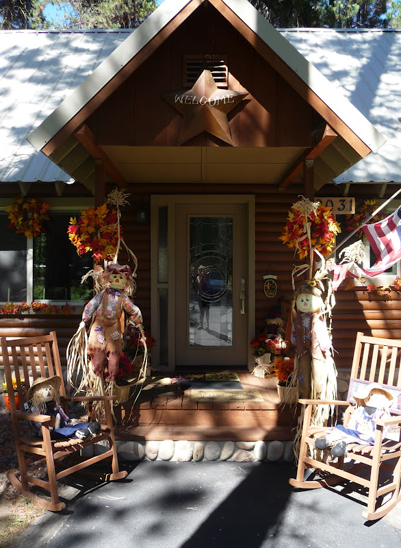
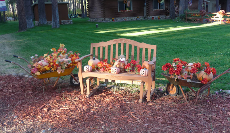
Photo- A happily married couple cardboard(?), Kimmie, Lindy & me.

We went for a late lunch/early dinner at the restaurant at Lake of the Woods. It’s a very scenic lake and resort area and they serve wonderful food too.  After eating we went walking around the resort area.  They had a wonderful gazebo, beach, swimming area, general store, and a small marina.  There were a lot of people enjoying the area doing all kinds of things like; swimming, sailing, boating, skiing, fishing and camping.  The resort has almost 20 cabins that can be rented out and RV sites with hook-ups that are available too.  We posed and took pictures around the resort; just generally being a bit silly.  It was fun.
Photo- Aunt Lindy ringing the bell.
Photo- The scenic --Lake of the Woods
Photo- Me on the beach with the Lake of the Woods and Mt McLoughlin in the background. 
Photo- Kayakers on the Lake of the Woods.
Photo- All kind of recreating going on at the Lake of the Woods.

Next, we drove around the Lake of the Woods, and got to see some of the summer homes that are built on the other side of the lake.  Some were huge and four stories tall and a few were smaller; and the views they had of the lake were wonderful.
Photo- The quiet beauty of Fish Lake.
Photo- Myself and Kimmie at Fish Lake with Brown Mountain in the background.

Then, we drove over to another scenic lake called Fish Lake.  It was a smaller lake with a great deal of camping sites but no resort area.  It was beautiful and quiet; just a nice relaxing place to hang and Grant (Kimmie’s fiancé) said that he loved to come here to fish because it was nice and quiet.  I could understand that and I watched some ducks dipping in to eat and splashing around. 

Photo- Ducks eating and splashing at Fish Lake.
We went back to Kimmie’s house.  We sat around enjoying her large lawn and visiting.  It was a wonderful way to finish the day.  Thank you Kimmie and Lindy!

Saturday, September 15, 2012

DAY 25- Newberry Volcanic Monument...

I managed to get in a quick waffle breakfast(YUM!) and then changed into my cycling gear.  I drove over where yesterday’s Happy Hour couple suggested I go.  It was out on the east edge of Bend and I was told it was a nice smooth 2-lane blacktop highway with a good shoulder that a great deal of the bicyclists in the area used.  The guy had teased that he’d be out there with Gatorade and possibly beer with Gatorade if I bribed him.  I just laughed because that’s not what I would need at 8am in the morning.  I was listening to a local radio station on the way over and there was a warning to limit your outdoor activities because the air quality from the fire over at Sisters.  I had hoped to get 20 miles in but I decided to do just a quick easy 7 miles; just enough to get the heart rate up.

I fueled up and headed south on HWY 97.  The goal for the day was to be at my Aunt Lindy’s by 4pm; the actual drive of which was about 2 and ¾ hours time.  It was basically a straight shot but I did have a least one stop that I wanted to make. 
Photo- Instead of the yellow brick road, I followed the red road.

I was planning to stop at the Newberry National Volcanic Monument which the Lava Lands Visitor Center is about 14 miles south of Bend. I turned in and flashed my National Parks Annual Pass at the gate.  Now I have a quick comment here; it seems that when you flash one of those passes at National places the attendant at the gate seems more attentive to you.  It almost seems like handing them the platnuim credit card.  The gal at the gate gave me a little time sheet and instructed me to park in the left lot but when my time frame came up to follow the red road over to the Lava Butte and also went on to explain several different parts and areas to the park; being very attentive but maybe that’s how all of those attendants are? 

I went into the visitors center and I found it very interesting because it explained the how and why that volcanic activity occurs and all of the results of it.  I thought it was especially wonderful and informative after seeing Mt Saint Helens.  It’s like I got a specific example of volcanic activity there at Mt Saint Helens but this was a more in depth generalized explaination of volcanic activity.  They had some wonderful displays and a 15 minute film that were very interesting. 
Photo- The Lava Butte that I drove around to the top.

Next, I was off on the red road for my 1.5 mile drive up to the top of the Lava Butte.  The road winds around and climbs up the side of the Butte and the view just gets better as you go up.  You can see for miles and miles.  There’s a very small parking lot at the top and I guess that explains the time sheet.  You are allowed a 30minute segment of time to be up there.  I walked into the exhibit which is actually a windowed room where above they show outside what the names of the mountain and buttes are.  I also took the quick hike around the top circumfrance of the butte.  There’s a small crater area at the top of the butte but they have a loose cinder rock path the goes around it.
Photo- An amazing but smokey view from the top of the Lava Butte.
Photo-Another amazing view with Mt. Bachelor off in the distance.
Photo- The plume of smoke fire from the Sister's fire.

Did I say the views were amazing?  They were and off in the distance I could see where the smoke for the Sister’s fire was at.  You couldn’t see Mt Jefferson because of the smoke where the two days before I could barely see the top of Mt Jefferson from the Timberline Lodge.  The fire was only 10% contained and there was concern because the winds had picked up and the temperatures were staying high during the day. 
Photo- From the Lava Butte Parking lot looking up to the forest service lookout
the upper part of building and viewing area around base of building.

There’s also a forest service lookout station at the top too.  It has served as a lookout for the forest service since 1928.  It made sense because of the unobstructed view.  I ended up talking with the forest ranger that was on-duty watch.  He was from Midvale, UT which is located in the Salt Lake City valley area.  He was heading home in another week; he said he was getting tired of all of this and waved his hand with a cigarette in it and rolled his eyes.

There are Lava River Caves about a mile south from the Lava Lands Visitor Center.  I drove right by it on my way back to getting back onto Hwy 97.  The lady at the visitor center mentioned rules because of the live bat population in the cave and that you could bring a flashlight or rent a latern from the small info. center nearby.  Live bats and dark caves--- hmmmm, really I think I’ll pass.

I again turned off to Hwy 21, which takes you to the large Newberry Crater.  The crater has two lakes that are used for boating and recreation.  The first lake I came to is called Paulina Lake and had a bit of that blue-green color that was similar to Lake Diablo.  The next lake was called East Lake.  There’s a great deal of campgrounds along the whole area and I could imagine it would be a wonderful place to camp.  There was even an area for a horse camp and there’s tons of hiking trails in the area too.

I was back off onto Hwy 97 and heading south.  I was in need of a fule up and it was past lunch time too.  I stopped at La Pine and fueled up and then drove through town.  There were the usual fastfood places like McDonald’s and Taco Bell but I wanted something more local.  That’s when I discovered the Red Rooster Café, as I neared the end of town. 

The Red Rooster is just open for breakfast and lunch only.  They close at 3PM and here it is 2:30PM.  I almost got the impression when I came in and sat at the counter  the older guy wasn’t happy to see me.  He said hi and handed me a menu with a wrapped up silverware.  He came back with a glass of ice water and just stood there waiting for me to order.  It was a bit unnerving.  But after a bit he did finally loosen up.  He reminded me a bit of an old billy goat gruff but a softy inside.  I asked him a couple of questions about La Pine and he answered them with short one word answers at first. 

I had to laugh when I asked what the economy in the area was based on and he said Nothing!  Then, he came quickly commented that a lot of the people in the area were retired from else where.  He had retired from the valley.  I didn’t ask which valley just nodded and let him talk.  He asked me a few questions and found out I would be in Klamath Falls area for few days doing whatever sightseeing with my Aunt and the next thing he was ring out the La Pine City map which had a map of the area on the back.  He was pointing out all of the lakes in the area that would be nice to see.

Just a little before 4pm, I was still about 60miles away from my Aunt Lindy so I called her and let her know that I would be about an hour later.  She said good because her and my cousin Kimmie were still vacuuming and cleaning before I got there.  I could hear Kimmie in the background yelling hi.
Photo- The beautiful sunset that I watched with my Aunt Lindy on her front porch.
I went to dinner with my Aunt Lindy to a cute little Japanese place on the main street of Klamath Falls where Aunt Lindy was a regular.  The server gave Lindy a bit of a hard time but it was all in good fun.  We had fun catching up and then walked back to my Aunt's house where we saw this colorful sunset.