Showing posts with label New Mexico. Show all posts

Wednesday, November 21, 2012

DAY 90- Three Months, Roswell, & Amarillo by Nightfall...

It was day 90 and it’s kind of hard to realize that 3 months has passed.  The time has just flown by.  I’ve done a lot in those three months; visited 11 national parks/monuments, went horseback riding for the first time, gone on a scenic motorcycle ride and boat ride, almost worked my way through 6 states, been on parts of Route 66, tasted a bit of wine, did a bit of gambling, tasted some wonderful food, visited a presidential library where I walked on an old Air Force One, biked some interesting spots, driven through some wonderfully scenic areas, did some hikes, attended a wedding, gotten stung by a bee, and several other things.  The list could go on for a while.  All these things I wouldn’t have done if I hadn’t taken that first step and said to myself,” No excuses; I’m doing this!” 

I’m really glad I did that and sometimes I admit I get a little bit uneasy because I’m SO out of the box that I’m not sure if I’ll ever be able to fit into a box again.  Where does this all end?  I’m very unsure and I never really thought about an “exit strategy”.  I just jumped in with both feet and never thought too much further.  I’m just going and living in the moment day by day.  I meet new people almost every day and have some of the most interesting conversations. 

But I know that this will need to come to an end.  The money will run dry and I know that over time I just can’t physically continue this pace of going and going and going.  Sometimes, you just need to stop and pause; give yourself sometime to evaluate where you have been and where you need to be.  I’ve got this going on in the back of my mind; mainly in the evening times before I fall asleep.  I ask myself—what do I really want to do when I grow up.  It’s silly but in essence this is a HUGE growing period for me and I’m not sure where I’ll be when I come out on the other side.

Okay, so with all that being said let me get going on what my day 90 was like…

I woke up to rain in Roswell, NM.  Ugh!  I managed to keep a bowl of cereal down this morning; that was a plus.  I’m wondering if it was something I had for breakfast or dinner the prior night that had caused yesterday’s sour stomach.  I had just gotten done with the shower when my hotel room door was opened by a maintenance staff.  Another two minutes later and he might have caught me without my towel.  He might have gotten a REAL eyeful!  LOL!  I think he was more embarrassed than I was; he quickly apologized and said that the front desk said I had checked out.  He left quickly closing the door behind him.  I had gone down stairs earlier to return a movie I had borrowed from the hotel and put an extra bag in my car but I wasn’t checked out yet; someone had jumped to conclusions.
Photo- The International UFO Museum and Research Center.

Later, I dropped off the keys at the front desk and said that the maintenance guy could now get in my room to fix whatever needed to be fixed.  They were all sorry for what had happened but I kind of found it a bit amusing.  I asked one of the gals for directions to the International UFO Museum and Research Center.  Then, I was in my car driving along the rainy Main Street area of Roswell.

I will tell you that most of the businesses rather play up the space alien stuff here in Roswell.  You’ll be driving along and a fast food sign will have a space alien holding the enter sign or there will be green statues standing on each side of the door.  Green aliens with HUGE black eyes are a common sight in Roswell.  I drove along to the old part of Main Street to the old theater that is now the place where the International UFO Museum and Research Center resides.  It’s rather hard to miss this place; and there are another couple of places nearby that stand out too.  I narrowed it down to just visiting this one place from doing a bit of web surfing the night before I found this place seemed a bit more authentic and interesting than the other tourist traps along the main drag.
Photo- It's set up to let you decide what to believe.

I paid the $6 entrance fee and started off in the Museum area.  There was a timeline of newspaper articles and pictures of UFO experiences in other parts of the world starting with the 1940’s.   Then, on July 4th, 1947 the Roswell experience happened.  There was a timeline of the next days, then weeks, then months afterwards.  Some of it was newspaper articles, some of it contained copies of signed affidavits from those that saw what happened.  It was all laid out in a fashion to let you decide what happened in Roswell.  To tell you the truth, it made me wonder about all of the possibilities and I’m undecided.

There was space alien art done in one corner and then the museum worked its way through the subjects of what a UFO is.  Then it showed photos of what people thought were UFOs; some of the photos had been examined and disproved for one reason or another, but others, well, they just don’t know.  Then, the museum covered the subject of space aliens being in art of ancient cultures and showed some examples.  Next, were the crop circles and the theories and possibilities.  It was all very interesting and rather entertaining.  They had a space ship with aliens out in a large open area that would periodically start making noises, lights would flash, and fog would come out.  But is there other life out there?  I think it’s egotistical of us to think we are the only ones but have they already tried to contact us.  I don’t know.
Photo- A fun little alien invasion within the
International UFO Museum and Research Center.

I went back through Roswell to head north; the goal was to be in Amarillo before night.  Hey, isn’t there a song about that?  I stopped before I left rainy Roswell at a place called the Rib Crib; a BBQ place that I would hope to have some of that famous Texas BBQ.  Though, I have to admit that I’m a HUGE fan of Kansas City BBQ so it’ll take a bit to dissuade me from that.  Well, it turned out that this was a BBQ chain and quite a few of their restaurants were in Kansas.  They even had one in my home state of Iowa; Mason City.  Well, I wouldn’t therefore classify this as Texas BBQ.  Oh, well but then again what did I expect… I was still in New Mexico.  Hello!??

The drive from Roswell to Amarillo was rainy and very, very flat.  I thought that Nebraska was flat but in comparison Nebraska is interesting because they have ponds and trees that they plant almost everywhere there along the highways.  This was barren and flat.  There were abandoned houses along the way, and a lot of people living in trailer homes out in the middle of nowhere; literally.  The rained started to clear up more as I got closer to Amarillo.  Just after the town of Hereford, there was a HUGE cattle holding pen area along the railroad.  It was a pretty smelly stretch for about 1 mile there.
Photo- A section of flat Texas.

The landscape did have a few hills getting up to the plateau that Amarillo is on.  I got to my hotel in Amarillo and got out of my car and there was that mild smell of cattle that permeated the air.  As some people would say, that’s the smell of money.  It’s not a new smell to me; growing up in Iowa which is second to Texas for beef producing I’ve gotten my fair share of smelling that, especially attending an agricultural college in Iowa.  But I have been living in a city in Utah for almost 23 years and have forgotten what that smell is like.

I ended up asking the hotel clerk about a good BBQ place and he was directing me to Famous Dave’s which is a BBQ chain that is all over the west.  I was looking for more local.  He told me of another place but it was closed on Sundays.  Then, I said that maybe I should just try an Italian place to which he gave me a suggestion of another chain restaurant.  Please don’t tell me this indicative of the people in the south that they love chain restaurants because then I can skip half of Texas in one fell swoop. 
Photo- The sunset from my hotel room window.
I made it to Amarillo before nightfall.

I opted to go to a place down the road called Salt Grass Steak House.  I’m sure it was another chain restaurant but I will admit that I had never heard or been to one of these before.  It wasn’t too bad.  The steak was good, cooked to order and I had sweet potato fries alongside the steak but they put maple syrup on the sweet potato fries which I thought was a bit too much sweet.  I ordered ranch dressing for the fries and the server looked at me funny.  I was half tempted to explain I was a Yankee to see if that might explain my strange behavior.  I have the feeling that I’ll be falling back on that excuse as I go along.

Tuesday, November 20, 2012

DAY 89- El Paso & Carlsbad Caverns...

The day didn't start out good.  My stomach rejected breakfast shortly after coming back up to the room.  I had a headache and I still had a 5 hour drive planned to get to my next hotel room for the night.  I swung by a nearby Wal-Mart for some Tums and then swung by a gas station where I amazingly paid less than $3 per gallon of gas.  I started the drive to El Paso, TX which is only about an hour’s drive southeast from Las Cruces. 

About 40 miles down the road the traffic started to pick up.  I entered into Texas with the sign “Drive Friendly the Texas Way”.  I was within a few miles of El Paso, TX.  The speed limit dropped from 75mph to 60mph.  I took the exit for the downtown area of El Paso.  I had about 1.5 hour to spend before I needed to be back on the road. 
Photos- Downtown El Paso.
I drove by the visitor’s center but didn’t see a place to park.  I drove around the block and managed to find the closest parking spot along the street.  The meter wasn’t taking any money and it only listed certain days for free.  I moved my car up two stalls and tried another meter; and found the same thing again.  I just figured I would take the chance of a ticket and walked to the visitor’s center.  I walked in and asked the gal at the center about the meter.  She said that she thought that it was free today and that if the meter wasn’t taking money that it probably was a free day.

I then told her that I only had short time to spend in El Paso and asked what she would recommend as a quick sightseeing thing in the area.  She suggested the historical tour of downtown.  I immediately crossed the street and started following the brochure.  But then I got side tracked and found myself about 2 blocks from the Mexican border and in a part of the downtown area that was filled with all kinds of shopping activity. 
Photo- Spanish section of downtown El Paso,
they've got Elvis inviting you to sell your gold!

It was like being in Mexico; everything was in Spanish and everyone was speaking Spanish.  Women had suitcases that they were pulling along with them as they were shopping.  I was trying to figure out if it was because they were buying so much that it was easier to get it home or if it was a case where they had walked over the border and were on their way to somewhere else for the night; naïve of me I know.  But it was all very interesting people watching and they didn’t even seem to mind or notice me walking along in the area.  There were some good prices on some of the stuff; I will say that.
Photo- Spanish section of El Paso's downtown, a hive of activity
with a Mexican singers moving along.

I walked down one side of the street and about half a block before I got to the border I turned around.    There was a solid line of cars with Mexican plates and some Texas plates too out on the road.  I walked back to the historical part of the downtown which seemed bland compared to what I had just seen.  I decided it was time to get back on the road.

Amid the El Paso traffic, I managed to find the exit I needed for the highway 62/ 180 that would take me to Carlsbad Caverns.  I drove east out of El Paso through a fair amount of heavy traffic.  Before I knew it, I was climbing out of the El Paso area and heading further east into a rocky layered terrain with curvy roads.  It looked like hills that had been lined with different colors; almost like sand art.  Then, I turned north after a while and got to a large flat area where there were mountains towering off in the distance.  The general direction of the road started towards those mountains and I kept on seeing a sign for a Guadalupe Mountains National Park.  Another national park?  I was already planning on going to Carlsbad Caverns National Park but I might be able to hit two in one day?  Bonus!  I thought to myself as I continued to drive north towards the mountains.
Photo- El Capitan in the Guadalope Mountains National Park in Texas.

Then as I got closer I noticed this amazing cliff face of one of the mountains.  This turned out to be the El Capitan and the Guadalupe peaks surrounding it.  It was amazing and I pulled over into a picnic parking area off to the side of the road to take a couple of photos.  Wow!  I drove a little bit further and around a bend where there were layered rock areas that the highway cut right through.  Shortly after that, I stopped at the visitor’s center of the Guadalupe Mountains National Park. 

I talked to a gal behind the counter and it turned out that there were mainly just hiking trails in this national park.  It was all roads accessing trailheads from the outside of the park but there were no actual roads that went through the park area.  It was very non-developed and in the natural state of how it was years ago which was wonderful but bad for me when I just wanted a quick look through.  I had to make it to Carlsbad Caverns before the 3:30PM deadline.  Nope, I would have to save this park for another day in the future sometime.
Photo- The scenery climbing up on way to Carlsbad Cavern's Visitors Center.

I jumped back in my car and headed north.  About another 35 miles down the road I came to sign for the turn off for the Carlsbad Caverns.  Yes!  It was 2:40PM and I would arrive before the 3:30PM last chance to head into the caverns.  I quickly drove the last 7 miles up winding roads to the visitor’s center that is situated at the top of a mountain.  I changed shoes to something with a gripping sole because caves can be wet and slippery.  Then, I grabbed my National Parks Pass and headed in.  I got a ticket for the cave, paid for a recommended audio tour player, and got in line for the elevator.
Photo- The red number tells you how far down you are.
I couldn't pay much attention on the way down
but was thankful on the way up that the number was getting smaller!

The elevator goes 750 ft. down to the cave.  This I had not known ahead of time and that was a good thing.  I was a bit concerned about my still uneasy stomach and the elevator’s descent but my stomach was fine; it was my ears that kept popping as we went down in the elevator.  The elevator has red numbers that show every 50ft down or up inside.  It was a very smooth elevator ride.  We arrived at a small waiting room at the bottom with a line of people waiting to come up; and there are circular rotating push through doors on each side of the room.  They had to install these doors to help ensure the proper air circulation was maintained to help conserve the caverns.

The cavern was a very wet humid type of environment, and it was HUGE.  There was a map that showed a 1.2 mile walk along the outer edges of the “Big Room” part of the cave.  I started on the path; stopping and taking pictures and listening to the audio as I saw numbers to enter for it.  You could take pictures of the inside of the cave all you wanted to though they did ask that you be considerate of others while taking pictures.  I waited till a couple had some distance in front of me and then I played with several different settings on my camera to try to figure out what would work best.  There wasn’t much lighting and what there was of lighting was focused on playing up certain parts of the cave.  I wouldn’t know if any of these would turn out for sure until they were downloaded into my computer later. 
Photos- A few of the pictures that turned out of the interior of Carlsbad Caverns.

The audio went on to give a description of the size of the cave and it was giving a comparative of a couple of football fields that could be covered over with the estimated amount of water to fill the cavern.  The ceiling looked to be about 50 or 60 feet above me in some places and here I had been concerned about being claustrophobic in the cavern.  There was more than enough room.  I stayed on the well fenced path area and didn’t touch any of the insides of the cavern as instructed by the elevator attendant. 

I found it very interesting that we as visitors leave something behind that needs to be continually cleaned by national parks employees… It’s lint!  I thought it would be something on our shoes or perhaps Carbon dioxide that we left in the cave but lint?  They said that the environment was similar to being in a wet dryer and that is when the dryer forms/collects most of the lint in its cycle.  You learn something new every day!  I did manage to make the full 1.2 miles around the “Big Room” of the cavern 15 minutes before the last elevator heads up to the top the last time of the day. 

Next, I ventured into the gift shop and of course purchased a couple of postcards and a bumper sticker.  I looked at the shirts but none of them appealed to me; in fact, I thought some of them were rather creepy looking.  Also, I was a little unnerved because they had a mechanical bat toy flying around in the gift shop area.   I didn’t stay long and out onto the 7 mile descent I went to the main highway I had come on.  I still had another 54 miles to drive to get to Roswell where I staying for the night.  And thus, I was driving towards one of the premiere UFO Capitals of the world as the sun was setting.  I was really hoping that I didn’t get abducted along the way.

Sunday, November 18, 2012

DAY 88- White Sands...

Everyone told me that I definitely needed to stop by and see White Sands while I was in New Mexico.  They would mention other places but always would reference back and say that I HAD to see White Sands for sure.  So I left my hotel in Deming and headed to Las Cruces with the intention of driving straight through Las Cruces to White Sands and then coming back to Las Cruces for the nights hotel stay.  Yeah, it was a bit of back tracking but there’s a bit of planning in my “madness”.  It just doesn’t always seem the most obvious (and sometimes it’s not always obvious to me either) but it seems to always work out.  So… here I am doing a bit of an out and back later in the day.

The first hour was a straight shot on I-10 heading east.  I was singing along with my iPod; as the radio was kind of in a dead zone for the most part except for a few Spanish stations.  Along this stretch, I-10 is about 15 to 20 miles north of the border to Mexico.  I’ve got my cruise control set and I imagine the people looked at me weirdly as they pass by and watch me singing along; crazy woman!

Just before Las Cruces, I take the exit for Hwy US-70 heading east.  I’m taking a chance driving to White Sands and not checking to see if they might have closed this road for a test at the White Sands Missile Range.  The National Park website for White Sands has a phone number you can call to see if the highway is going to be closed that day or not.  I was taking a risk of possibly sitting in my car on a closed section of highway for three to four hours. 
Photo- The sign letting you know you are entering White Sands Missile Range.

Luckily, the highway ended up not being closed.  I drove up and over Organ Mountain and then past the White Sands Missile Range.  It made me a little leery driving through this area.  But I continued on.  There were quite a few vehicles with government plates passing me like I was standing still and I was doing 5mph over the speed limit. 

About a mile before I got to the turn off for White Sands National Monument, the speed limit was reduced and there was a border patrol check.  I felt like I had done enough of these as of late that I should be on file, or something.  I pull up to the stop sign and the guy asked the normal are you a US Citizen.  Yes, I am; I said.  Then, he asked what the purpose of my visit was.  I told him today it was to visit White Sands National Monument.  Then, I told him that I was on a road trip and that this would be my 6th or 7th National Park that I’ve visited.  He asked by yourself?  Yes, I told him and then said Crazy, huh?  He laughed and wished me a good day.

A mile later down the road I took a left into the White Sands National Monument parking lot at the visitor’s center.  I went in and looked at some displays and watched a 17 minute movie about White Sands.  There was a 6.5 mile loop drive into White Sands.  The entrance fee per car is $3 or in my case free when you have an annual National Parks Pass.  The gal at the visitor’s desk said that I could take 3 more passengers along on my pass if I wanted to.  I told her she hadn’t seen my filled up car or she would not have even mentioned that.
Photo- The White Sands Visitor's Center.

I left the visitor’s center and headed along the road to the gate.  I showed my annual pass and the gal talked about the highlights of the 6.5 mile road with a turn around.  Two miles in there was a desert nature hike that was a 1.2 mile hike in sand but would give me an idea of what the dunes were all about.  Four miles in was a boardwalk that was an easy ¾ mile hike.  There were picnic areas about 5 miles in and the turnabout was 6 miles in.  She really suggested the nature walk if I was looking for the best of White Sands.
Photos- Some of the AMAZING scenery that I saw on the nature hike in White Sands.


I drove in the two miles and parked in the parking lot for the nature hike.  It sounded like the best bet and I was really looking forward to really getting a feel for White Sands.  When I drove in, I could only see the edges of the dunes.  I walked the dirt path over to the base of the dunes and up I went; and Wow!  Man camera was getting a workout as well as I was from walking around in the sand.  I could feel my shoes gaining sand weight as I walked along.  Every so many feet there was a new sign post that had a factoid about the animals and life in the dunes.  I was rather surprised that there was so much life within a sand dune.  It appeared that most of the life occurred at night and that most of the wild life had adapted to their environment in some way like; the lizards were white, and the fox which was the largest predator in the dunes was small and big eared compared to other foxes out in the wilderness.  It was amazing and very educational hike.
Photo- I couldn't resist not putting my mark here!  It might last a day or two at most.

Next, I got in the car and drove to the boardwalk.  I got out of the car and started to walk along but the boardwalk was basically the same signs as the hike I had just done and it wasn’t nearly as pretty as the area I had walked.  I turned around about halfway out.  I got back in the car and drove along the road further into the dune.  It was amazing with the dune all around except for the paved road.  There were areas where sand was venturing onto the road.  I wondered about what kind of maintenance they had to do on the road to keep it clear.  Did they use a street sweeper to keep it clear? 
Photo- The paved road through White Sands.

About another ½ mile down the road, the speed limit dropped down to 25 mph and there was a sign stating that it was the end of the pavement.  Now I was driving on the dune and it was very surreal in that the whole landscape looked white like snow but it was actually sand.  Cars and buses were driving along the area and if it hadn’t been for their presence I would’ve felt like I was in another world altogether. 

About 5 miles along there was a sign for a picnic area and there were restrooms there too.  I swung in their out of curiosity. The picnic table areas were very unique and looked other worldly too.  I drove around that area for a bit and then worked my way back over and around the loop at the end of the drive.  There were large cleared turnout areas here and there for people to get out and climb up a dune, or take pictures, or to sled the dunes.  Yes, I said sled. 
Photo- The boy showing me how it is to sled on a dune.

I drove up to a mother and her son who were sledding one of the dune areas.  I asked how the sledding was.  The mother encouraged her son to show me how the sledding was and mentioned to me that it was quite a bit slower than snow.  The boy climbed back up the hillside of the dune and at the top jumped into his sled.  He really had to push to get any kind of start with the sled and then had to push here and there as he went down the hill too.  But it did look fun.  The mother said that the sleds were on sale at the gift shop at the visitor’s center if I wanted to give it a try.  I thanked her and her son for showing me; wished them a good day and back in the car I went. 
Photo- It's sand but it looks like snow!

I drove slowly here and there along the road back to the visitor’s center.  I stopped to take more pictures as I went along.  Back at the visitor’s center I went into the gift shop and purchased a couple of postcards and a bumper sticker.  I decided not to purchase the $17 sled; just to give sledding a chance on a sand dune.  What would I do with a sled afterwards?  It wouldn’t fit in my car.  I decided I would head back to Las Cruces and my hotel for the night.  But I will say this it was a wonderfully amazing experience being at White Sands and I would highly recommend people visit this wonderful area.

DAY 87- Truth or Consequence to Sliver City...

I got an early start for the day.  I had almost a 6 hour drive ahead of me planned for the day.  I’m trying to pick up the pace just a bit because I want to be in Dallas for Thanksgiving.  I headed south on I-25.  The landscape changed over the next two hours from distant mountains to flat barren desert like to rolling hills with distant mountains.  There was even one section of between that was referred to by the Spanish as “No Man’s Land” in that many a man had died trying to cross this stretch of land.  I could see how because even with the interstate cutting straight through it; there seemed to be a mirror image of the same land on both sides.  I could see where with no roads or any landmarks one could get easily lost in this area.
Photo- The flags flying high in Truth or Consequence, NM.
At exit 79, I had almost arrived at my first destination of the day.  I was in the town of Truth or Consequence.  Yes, that’s the actual real name of a town in New Mexico.  I drove along through town past the Geronimo Springs Museum and over to the Veterans Memorial Park.  It’s a plot of land just off of the main drag area that has been dedicated to all veterans.  It is only 3 years old.  It started with one of the Veteran’s Memorial Traveling Wall (the “Walls that Heal”) that needed a home that the state of New Mexico bought and a group of businessmen in the area that decided that this town was to be that home; and it grew from there and is still growing.  The land was donated and people have donated their time and energies to help make this into what it is and hopefully into what it will become one day too.

I pulled in and parked.  I walked along a sidewalk where there are bricks with names of those who have served and lost their lives.  Some had flowers or other items setting just off the side of the bricks.  In the center before you get to the traveling wall there’s a grouping of flag poles with flags.  At the center of and the tallest is the US Flag with a POW-MIA flag directly beneath it. Then I walked along the traveling wall that now has a permanent home.  The names; and there are so many of them.  It left me speechless and a little bit emotional that so many have died for our country. 
Photo- Part of the Educational Walk at the Veterans Memorial Park.

Next, I walked around that wall to an area that’s called the Educational Walk.  This walk is in the shape of star of a Congressional Medal of Honor with a globe and eagle serving as the guardian to this walk area.  On this walk there are pedestals with plaques for each of the wars that happened to make our country what it is today.  It starts with a plaque about the Revolutionary war and goes to present day wars.  Quite a few of these wars have the stats on how many died and how many were wounded.  The last of which is blank except for the name of the conflict which I saw as a very powerful statement that this is not at an end.
Photo- Inside the Hamilton Military Museum.

I then walked into the Hamilton Military Museum; where they were two volunteers waiting to greet me and answer any questions that I may have.  This museum is a living memorial to those that served in the armed forces.  There’s letters, uniforms, artifacts, and pieces of history that are preserved for generations to come.  I guess that parts of it change from time to time too.  It was all very interesting but I found myself kind of reacting emotionally to all of these people having died for our country and I made a quick donation in the jar and left.
Photo- Some of the scenery on the way to Hillsboro.

Off down interstate I went.  I turned off on exit 63 and onto a back road Hwy 152.  I was on my way to Silver City, NM which I had been told was an artistic area.  The road went up and down.  There were several signs that said look out for running water; a new sign for me.  The speed limit dropped and the road became curvy and, of course, scenic.   The speed limit dropped down to 25 mph and I entered Hillsboro, a small hamlet amid a mountainous rocky terrain.  A cop car was parked midway through the town with no cop in it.  A few local people waved as I went through the area.  I waved back.  I didn’t know these people from Adam but why not wave back too?
Photo- The rocky landscape and curvy roads between Hillsboro and Sliver City.

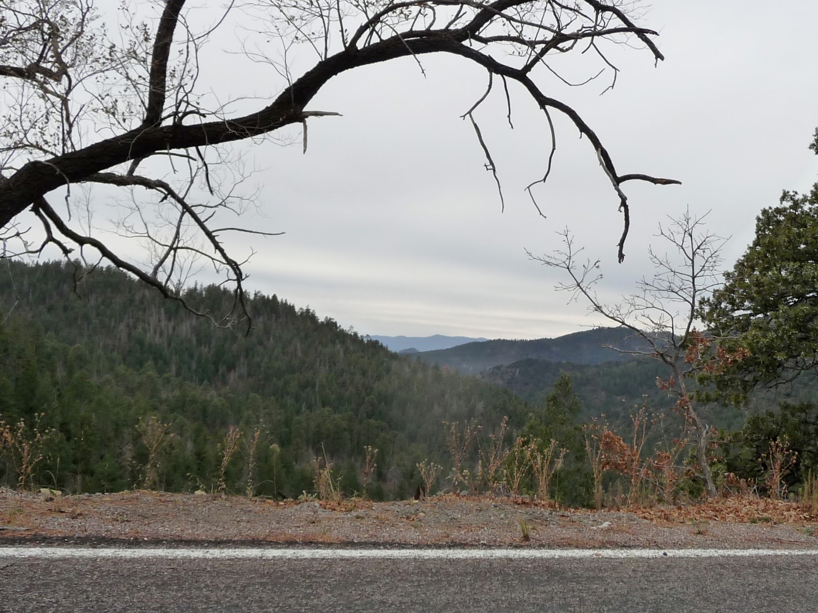
After Hillsboro, the road became even curvier and started to climb and climb and climb.  I was driving through the Gila National Forest.  The terrain was rocky with a forest of juniper trees with prickly pear cactus scattered among them here and there.  I thought it was gorgeous.  The speed limit was between 15mph to 25 mph because of the curves.  Every now and then a truck or car would come from the other direction.  Quite a few of them would be waving as we drove past each other.  It was just the local people in the run down vehicles because the BMW’s and the Mercedes just turned their nose at you.  This friendliness was rather nice, inviting, and refreshing.
Photo- The trees are getting taller as I move further up the mountainous terrain.

I was driving in the nose bleed section of these mountains and the view was gorgeous.  The trees got taller and changed into evergreen trees.  I did a bit more climbing in my car and then I was going over Emery Pass.  I could see for miles over my right shoulder just before I went through the pass.  Amazing!  Then, the road descended with curves and all.  There was more waving from locals and a guy on a motorcycle.  The landscape changed back to shorter juniper trees with cactus.  Then, I saw cyclists and slowed.  The road was very narrow and had no shoulder at all in quite a few places.  But with the views and the challenge of climbing, I couldn’t blame the cyclists for being up here.  It would be a great place to cycle.
Photo- Oh the amazing view between the trees as you get closer to the top!

Soon, the road widened and I was at a junction with Hwy 180.  I turned right towards Sliver City.  As I am traveling along on the south side of the road are carved mountains with all kinds of copper and rust colors.  It looks like a mine.  Off on the left I see a viewing area for the mine and I pull into it.  It’s the Santa Rita Copper Mine which claims it is the oldest operating mine in the country.  It’s a pretty good sized hole in the ground and I wonder how it compares with the Kennecott Copper Mine just outside of Salt Lake City.  I took a couple of pictures while 4 older guys there standing looking and talking together; the women are sitting in the cars.
Photo- The Santa Rosa Mine the oldest operating mine in the US.

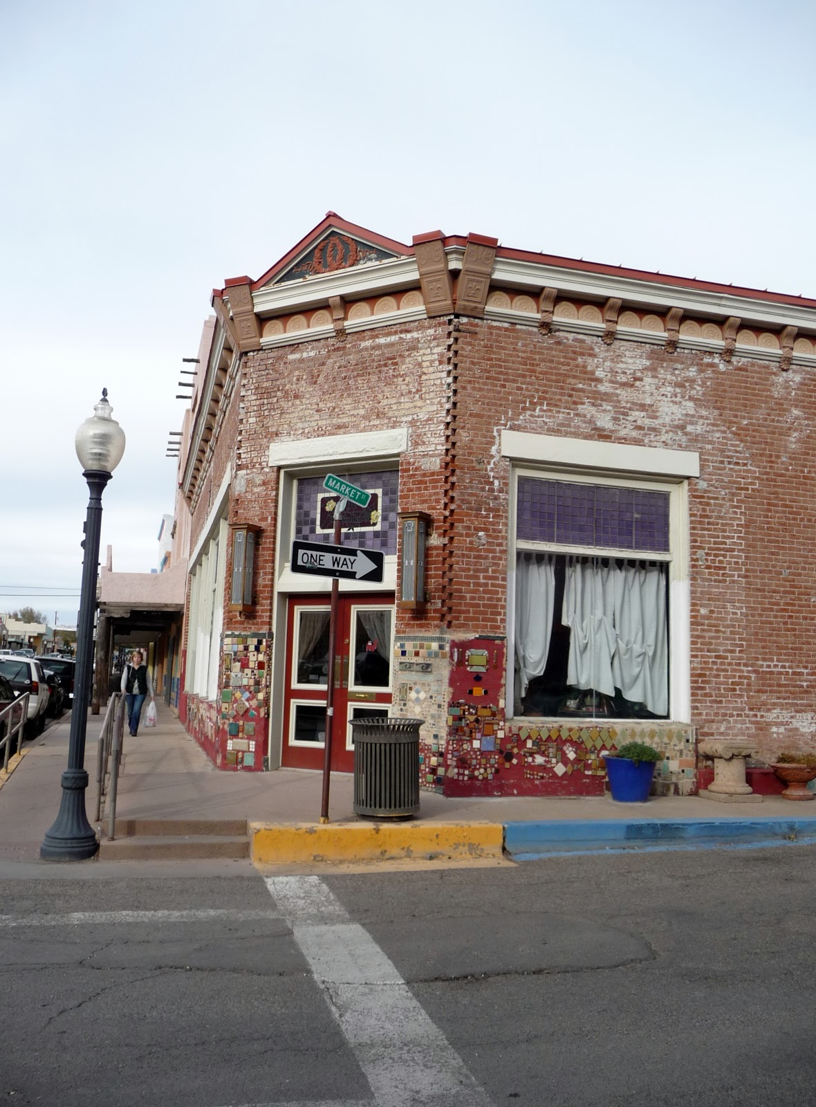
I jumped back in the car and continue on to Sliver City.  I follow the signs to the Main Street Historic District.  You know, there seems to be a slight correlation between historic district areas and artists.  Why is that?  Maybe us artists are drawn to them?  I park the car and started to walk along the street.  I get several “HI’s” from what I gather are locals.  Boy, they are a friendly lot here.  I walk down one side to another.  It’s about 4pm and some of the shops are already closed even though by their hours they should be opened.  I went into a couple of shops. 
Photos- Older colorful buildings in Sliver City, NM.
 
One shop I went into, I overheard the guy saying on the phone that he can’t close up just yet cuz he has customers.  I went into a jewelry shop with very inexpensive prices.  I couldn’t pass up pairs of earrings for $3 to $5 per pair.  I spent $15 and got 4 pairs of wonderful earrings.  I talked with the clerk and he had moved from California.  He’s semi-retired and just does this to keep himself busy more than anything.  The people are very nice here he said.  I told him about the waving and he said yes that’s the locals.  They are courteous drivers too he said.  I continued on but more and more of the shops were closed.  I went into a textile crafts and art shop.  I talked with the clerk there too.  It was about the same things.  How friendly the people are and that’s why her husband and she moved here.  They were in California.
Photo- Interesting artistic details that they do to the buildings in Sliver City, NM.

I headed back to my car and drove towards Deming where my hotel was for the night.  I watched the flat area between Sliver City and Deming change from dusk to pitch black night.  There wasn’t much out in this area at all.

Friday, November 16, 2012

DAY 86- Alpacas & Rough Riders…

Yesterday when I drove through Mora, which is north of Vegas, NM, I saw a sign about feeding Alpacas at a place called Victory Ranch.  It was almost the Ranch’s closing time when I drove through but I thought I might still check it out.  So here I was doing a bit of backtracking so that I could have the opportunity to feed live Alpacas.  Yes, that’s the story of my life these days; as sad as it may sound.
Photo- Alpacas out grazing in the field at Victory Ranch.

I drove to Mora about 29 miles north and halfway through town I turned right and headed east.  At mile marker one, the ranch was off to the left.  I had driven by Alpacas who were out on in the field for about the last ½ mile.  I followed the signs and took a dirt track back to a barn like store towards the rear of the complex.  I parked and went in.  There were all kinds of wonderful wool products available for sale.  I asked the girl if I was too late for the 11AM feeding for the Alpacas.  It was a couple minutes after 11AM, and the next feeding time posted was 1PM.  She said that it should be no problem and got on the phone.

I paid my $5 fee and she set me up watching a video about Alpacas while I waited for Brian to show up.  She said he does the educational talk before you go out to feed the Alpacas.  I had just barely managed to sit down and watch the video when Brian turned up with a Folgers plastic coffee can in hand.
Photo- Brian, Mr. Educational, at Victory Ranch.

Brian led me out to the veranda part of the store, had me sit down on a bench, and started explaining the history of Alpacas.  Alpacas are related to camels.  There used to be camels in North America and some moved over the land to South America and others moved over to Asia and Africa.  They’ve all adapted to the climates and have changed from the original camels.  The camels in North America became extinct in the 1200’s; but the others have survived.

Brian went on to explain that the different aspects such as; breeding, sheering, and how the farm is set up.  There are four dogs and four lamas to protect the Alpacas.  The four dogs I understood but the Alpacas?  That was new to me.  But they are gentle with the herd and fierce when it comes to protecting the herd.  They will attempt to stomp on any predator.  It’s their natural instinct, and they are also related to the Alpacas only they were breed for carrying rather than for their fur.  He went on to tell a couple of stories of when they’ve had the lamas cornered wolves.  It was all very interesting.
Photo- Coal entering into the pen with the kindergarten crew of Alpacas.

Photos- Feeding the Alpacas.
 
Then, Brian used a walkie talkie and had Coal come take me out to feed the Alpacas.  I would be in the pen with what they called the kindergarteners; all of which were still in their first year.  They did the feedings of these youngest ones so that they could get used to being around people.  That way it would be easier later on to deal with them when it was sheering time.  Coal walked to the pen and right away they spotted the red Folgers coffee can.  They knew what was coming and they were all gathering at the gate.  Coal poured a little on the ground and then let me fill my little cup with some so I could start feeding them.  Quite a few of them were working on the ground but a few were watching as I got prepared to feed them.

I put some from my cup into my open slightly cupped hand and here they came!  One that was called Duke was especially a greedy one and stayed right by my cupped hand waiting for me to fill it.  Duke had this figured out.  I kept on moving my hand to let other get a chance and there were plenty of them wanting their chance.  There were almost 20 of them in the pen.  In general they were not very aggressive at all; rather docile.  They have no upper front teeth just bottom teeth so it was rather interesting having them feed out of your hand.  The feed had molasses and oats in it and this was a treat for them; normally they would be munching on grass out in the field area.  I was allowed to continue feeding until the Folgers coffee can was empty.  It was a fun experience.
Photo- Duke, the greedy Alpaca!

I drove back south through the ghost town of Mora and past Storrie Lake; into Las Vegas I went.  I was headed to the town museum where part of the museum is dedicated to the Teddie Roosevelt’s Rough Riders.  I parked outside and went in.  I was welcomed and told there was no charge but there was a donation box if I wanted to donate.
Photo- Gear from the Rough Riders in one of the cases in the Las Vegas,NM Museum.

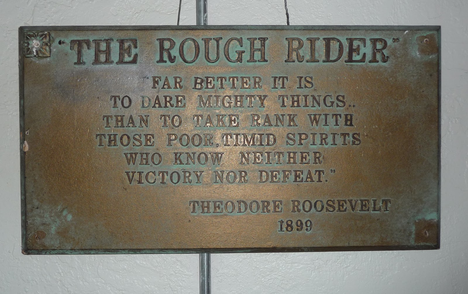
The Rough Riders as they came to be known were the 1st US Voluntary Cavalry Regiment led by Theodore Roosevelt.  Quite a bit of the collection in the Las Vegas museum is material from the Cuban Campaign of 1898 Spanish-American War.  But there are photos and objects from the Rough Rider “Reunions” that took place in Las Vegas, NM too.  The Rough Riders were a tight knit group and met for yearly for reunions.  The first reunion took place in August of 1899.  Las Vegas at that time was the BIG city in the area and was convenient by railroad.  There were reunions in other cities such as; Oklahoma City, Colorado Springs, San Antonio, and Prescott, AZ.  But those that were left voted to hold any further reunions in Las Vegas.  The last “reunion” was held in 1968; one of the last two remaining past away later that year.  The last man standing of the Rough Riders pasted away in 1975.
Photo- Plaque of famous quote made by Teddie Roosevelt.

Also at this small town there were memorabilia and signs from the HUGE Cowboy Reunion and Rodeo which were quite the event in Las Vegas for years.  It also seemed to fit in nicely with the Rough Rider Reunions.  Las Vegas also happens to be on the Santa Fe Trail which there was old road signs and move memorabilia from that too.  It was quite the interesting little museum.

Photo- Statue in Las Vegas Plaza area.
Photo- Some of the historic building on the Plaza in Las Vegas, NM.

Next, I wandered down to the Plaza area of Las Vegas.  It’s an oval city park plaza area that is surrounded by older historic buildings.  There was a colorful sculpture in honor of “Our Lady of Sorrow Parrish” and Mothers Against Drunk Driving.  Our Lady of Sorrow Parrish was the first Catholic Church in the area.  I walked around the square and checked out the buildings and what not.  Then, I had lunch at El Rialto Restaurant which Coal at Victory Ranch had recommended.  He grew up in Las Vegas and said it was his favorite place outside of his girlfriend’s cooking.  But he did say that anything in the Plaza area was good.

I ordered the three combo taco special with posole, which I have never had before.  It was the posole or Mexican rice, and I had never tried it so I thought what the heck (sorry hanging out in Utah too many years).  Posole is hominy spiced up, AND I happened to discover that I didn’t like it.  However, I LOVED the tacos.  These tacos were made from scratch right down to the taco shell.  They were amazing!  Then, I had fresh made to order sopapilla with honey for dessert.

Next, I was zooming along on the road on my way to Albuquerque for the night.  From there I would head further south, and I hope on to warmer weather.  I ended up getting stuck for a while in Albuquerque rush hour traffic.  But I will say it still didn’t hold a candle to the San Diego Rush hour before Monday Night Football.  I took an easy night in and ended up doing laundry.  I was a bit over due for this but now was the time.