Showing posts with label farms. Show all posts

Friday, November 2, 2012

DAY 72- Biosphere 2 & a BIT of Halloween Fun!

I got up early and ran 1.5 miles in the hotel gym.  I’ve decided that I’m going to try to do something active every other day to try to keep in shape.  I’ve noticed some of my clothes have been a bit snug of late.  Some of that could be due to them being dried in an actual dryer where when I lived in Salt Lake I always hung the clothes to dry.  But I do a fair amount of walking with my travels and am getting some but I could always use a bit more.  After all, I need to keep my bikini shape.  Ha-ha!
Photo- The Hertiage Hall which used to serve as a church in Casa Grande.

After a quick small breakfast, I loaded up the car and I was off.  Down the street about 2 blocks, I went to a rock church that I had seen last night.  I got out and went to the museum doors to discover they don’t open until noon.  Noon?  I was hoping to be long down the road by then.  So I just walked around the area, read some signage, and took some pictures.  It was an interesting little church that had been built in 1927 with fieldstone (stones from local desert area) and served as a Presbyterian church until the 1970’s when it fell into disrepair.  It was renovated in 1984 and since has been in use as a community center and theater.  It was cute and I wish they would have been open to see the inside.  But, oh well!
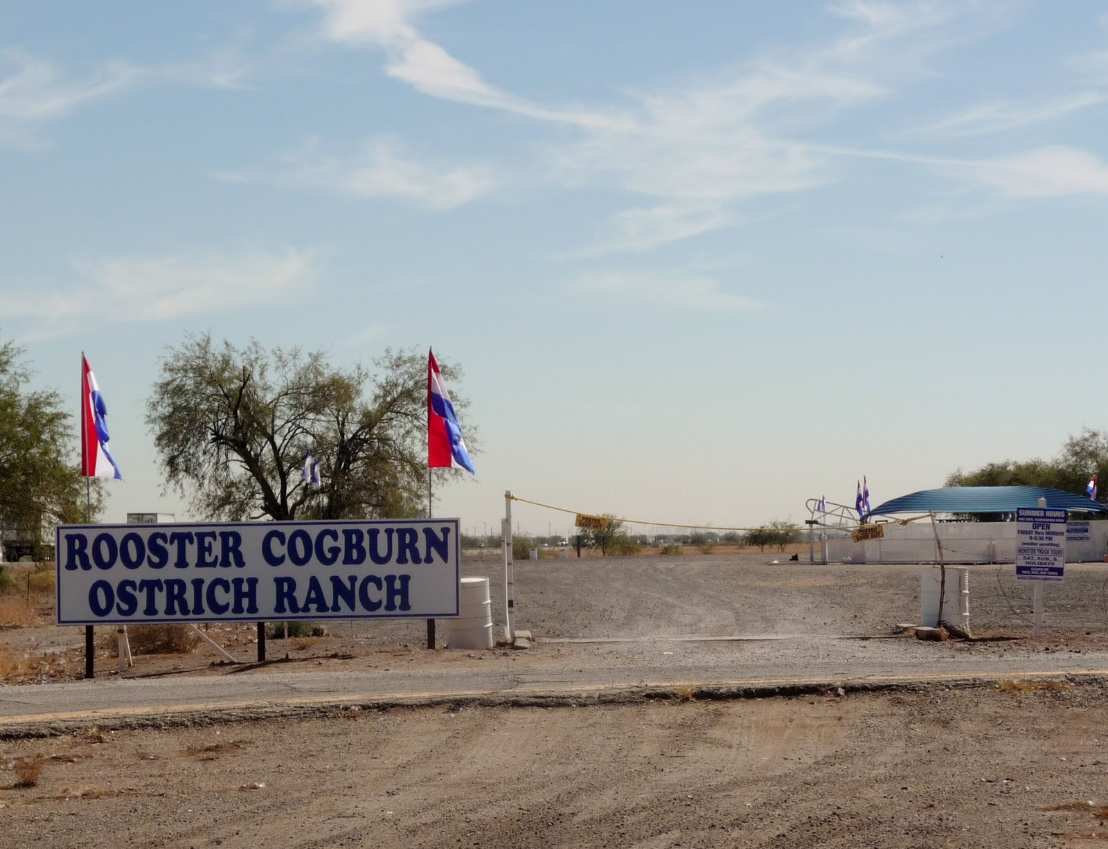
Photo- Closed! DARN IT!

Off I went over to I-10 heading east towards Tucson.  Last night while talking with Terri, I had heard about an Ostrich farm where you could actually feed the ostrich; that sounded like something fun and interesting.  It was just off an exit on I-10 and I thought I might just go ahead and do that.  I drove up to the entrance only to discover it’s closed on Tuesday, Wednesday, and Thursdays.  DARN! 

I drove back up to the Interstate exit and went across to the Dairy Queen that Terri had told me was the best in the state.  It was lunch time and I ordered some chicken strips and a small pumpkin shake.  I told the gal at the counter that I heard they were the best DQ in the state.  She said that it more of a case that they were the only well stocked DQ in the area.  The food was fresh, good, and served hot.
Photo- The scenic back roads way to Biosphere 2.

After lunch, I took off on the frontage road and drove through back roads on my way over to the Biosphere 2.  It was wonderful scenic drive with the windows down.  35 miles later, I arrived at the entrance to Biosphere 2; not sure of what to expect.
Photo- The entrance off of the highway for Biosphere 2.

I paid my entrance/tour fee and then proceeded to door #8 which is the air lock door to the Biosphere 2.  I went in and waited with others in a theater room.  The blonde girl that was to be our tour guide started a film that talked about how Biosphere 2 developed and became what it was today.  The film also talked on the subject of how Biosphere 2 is a smaller designed version of our earth which is referred to as Biosphere 1.  The hope is that by studying this smaller that we can learn more about the earth we live on.
Photo- Biosphere 2 as seen from the guest compound situated nearby.

After the film we got to tour some of the actual Biosphere 2.  We went from the entrance area to a walk way through the ocean area and then through a door into the rain forest room.  It was interesting how we went from a salt wet atmosphere and into a hot humid atmosphere in such a short distance.  Our tour guide talked about how currently they are doing an experiment in the rain forest area on the effects of drought in a rain forest.  Drought in a rain forest?  But there was still water for a water fall.  It wasn’t a total drought but a percentage of less water that would cause a drought for a rain forest.  There were sensors all over the environment measuring different factors within the area of the rain forest she told us; though, I couldn’t see any actual sensors.
Photo- Inside Biosphere 2, heading up to the Ocean walk way.

Photo- The Tour guide explaining in the Desert section of Biosphere 2.
We back tracked a bit; going back through the ocean room and into the savannah area.  She said there’s always a savannah area that separates an ocean from a desert.  She stopped here and explained a barren area along the walk way that had just finished being used for a prior experiment.  They were now preparing for the area to be used for another experiment but she didn’t have any of the details about what that experiment would be.  She also mentioned about how there are birds and various other animals that were left over from the locked down time of the Biosphere’s history that still remain in the Biosphere 2.  She said however that they were never kept track but that currently the system is open and that there may be other wild life that may have gotten into the Biosphere 2 also.  I found it interesting that they were keeping sensors on atmosphere, temperature, and water but were not keeping track of animals in the system.

Next, we went into the desert area where they were doing an experiment of 7 degrees lower temperature.  It was rather cooler than what I would expect a desert to be.  She explained that a desert was a crucial part of the Biosphere 2 because of the fog that is produced in the desert area is a way to retrieve water in the whole system.  This I found an interesting concept because I never thought of fog in the desert.  They also had another experiment going on in the desert area that was controlled in closed of plastic covered vessels.  The experiment was trying to test how much is needed to grow plants in rock and lava soils.
Photo- A lot of mechanical equipment needed to maintain Biosphere 2.

From the desert, the tour took us to the bowels of the Biosphere where we walked through the heating and air conditioning systems of the desert part of the Biosphere 2.  Hold on to your hat in this area!  It’s very windy just before you enter into the mechanical rooms.  It was amazing what machinery was needed to maintain just one area of the Biosphere.  We took a peak down another hallway that looked like it went on forever.  These were the mechanics for the rest of the Biosphere 2.  I found this all rather interesting because about 72 days ago I was a secretary in a small HVAC mechanical firm.

Next, we went in an underground tunnel that went on for 200 ft. At the other end we came out into an area that’s called the lung for the Biosphere.  The lung serves the purpose of an area where pressures within the system can escape.  The ceiling of the lung is made a neoprene rubber which contracts or expands as necessary.

Then, we went outside where our tour guide pointed out different areas on the property.  Through another door we went walking by the LEO experiment which is the latest largest thing to happen at the Biosphere 2.  LEO is an experiment to measure water in a sloping earth landscape.  There are three large tunnels areas that are currently being prepared with soil which has sensors all around it.  The general idea I got from the explanation of the experiment is that they are testing what happens to water as it goes over a sloping landscape to see how much of the water runs off, how much is absorbed into the soil and how deep some of that water is absorbed into the soil.
Photo- A residence room of the Biosphere 2 on display for the tour.

We went upstairs into the living quarters of the Biosphere 2.  It was here that the tour ended.  We watched a video on a TV screen in what served as the dining room of the facility where you could look into the kitchen area.  The video spoke about about the cooking and gathering of food that occurred during the 2 years the Biosphere 2 was a locked down system.  The Biosphere hit a wall during those two years in the experiment.  The humans couldn’t maintain enough of a calorie intake that they were all losing weight. They found it too time consuming to plant, grow, and harvest food on top of their other duties of experimenting.  Plus, the mechanical aspect of the facility was time consuming too.  It was all too much for them to do.  To the outside world this was seen as a failure but to the scientific world is was much needed data for future experimentation. 

I walked around the outside of the facility reading other signs along the way and then took an elevator down to look into the side window of the ocean.  It was strange because the color of their ocean was yellowish in color.  There was an explanation for that which I can’t remember now as I type this.  But it made sense at the time when I read it.  Sorry, my brain can only hold so much, and it was getting quite a bit of information within the 2.5 hours that I had spent there.

Off to Tucson, I went and ended up getting bogged down for a bit in rush hour traffic.  Well, it was 4:30pm going on 5PM.  I managed to eventually find my way to the west side where I would be staying for the next 2 nights at Starr Pass Golf Suites.  I found them on-line through hotel.com and they weren’t too bad of a deal for a couple of nights stay.  I arrived at the Starr Pass Resort and quickly got lost trying to figure out where to check in at.  I didn’t see a specific area that was labeled as an area to check in or even a real club house.  So as I’m driving around I see a guy on a golf cart with a colored polo that says Starr Pass.  I flag him down and asked where I can check for my room.  He, Alberto, gives me directions to a large building that I had driven by.  He says if I need any further assistance to feel free to just call him.

I head back and park in front of the covered over hang area.  No labels or signage anywhere.  I pull the door open and there’s a lobby area, a restaurant, a bar, a pro golf shop, and a front desk area.  I go up to the desk and the whole time I’m checking in she kept on referring to me as Miss Allgood.  Not that I’m complaining, it’s just that I’m not used to being referred to as a Miss and I’m not often called by my last name either.  She gave me a map and a typed up information sheet about my room.

I’m back up driving through the area trying to find my room when I stumble upon Alberto again.  He stopped off to the side of me and asked if he can help me.  Yeah, I say I’m lost again.  He turned his cart around and lets me follow him to where my room is.  All of the rooms in this place are like separate single level townhomes that just vary in size and features.  I thanked Alberto and again he said if I needed anything to feel free to just give him a call.  I had to laugh because he doesn’t give out a number or a way to actually reach him when he says this.

I get inside the room and see a desk for a computer but no chair.  I called the front desk and asked about the chair if the room is supposed to have one.   The gal said yes there should be one and that she’ll send someone over with a chair in a short bit.  A short time later who shows up at my door with a chair?  Yep, you guess it Alberto!  I laughed as I open the door and told him I’m not usually this much of a pain in the ass.  He laughed.  He brings in the chair and I ask him about restaurants in the area.  The next thing I know he’s jotting down directions to a Mexican restaurant that he says I will really like.  He says that I should dress up for Halloween because they are probably doing specials for those that are dressed up.

So 20 minutes later I head out in a squashed cowboy hat and jean skort overalls armed with the directions.  I did find El Charro which I later found out is the oldest Mexican restaurant in continuous operation by the same family since 1922.  BUT I appeared to be the only customer in costume and the only other ones that were dressed were employees.  I think I was being played by Alberto!  But the hostess got me a table and I have a WONDERFUL Mexican meal. 
Photo- The interior of the El Charro restaurant.

Right from the start, one taste of the salsa that comes with the chips and I knew I was in the right place.  SO GOOD!  I could’ve made a meal of just the salsa and chips but with quality and flavor like this I HAD to try their mole.  OMG!  The chocolate mole sauce was a blend straight out of heaven; sweet and spicy but so much more flavor served over a tender piece of chicken that rested on a bed of rice.  I was in a food heaven that was quite colorful and had costumed servers running around.  There was the cop hostess, a Scooby Doo, a Charlie Chaplin, an Irishman, a Hippie, and my server which was Jack the Skeleton King. I asked to take a picture with my server and the next thing I know I’ve got three of them jumping to get pictures. 
Photo- Some costumed characters with me.

Next, I went into the bar next store which is part of the restaurant.  I had a beer over there but it appeared that they were closing down early because it wasn’t very busy.  That’s okay I thought this was enough for tonight and I still needed to figure out how to get back to my hotel from where I was.  Plus, I needed to do some blogging too.

Thursday, September 20, 2012

DAY 30 -Rogue-Umpqua Scenic Byway…

I planned on a scenic drive through central southern Oregon for the day.  Grant, Kimmie’s partner, had mentioned a nice route to drive but that it would take a whole day.  So I started out early; skipping breakfast and heading north out of Klamath Falls.  I passed by the Upper Klamath Lake and all of the pelicans.  I took Hwy 140 west after Rocky Point and went past Lake of the Woods and Fish Lake off into new Oregon territory for me.


Photo- Pelicans on the Upper Klamath Lake.

Shortly after passing Fish Lake, I took a right turn on to County Rd #821 on my way to Butte Falls.  I was driving through wonderful scenic forestland.  The road got rather curvy and I started to slow for the turns.  Before I knew it I was coming around a corner and BOOM!  There are cows in the middle of the road! COWS?!?!  Yes, I was in the middle of an open range area which happens quite a bit in Oregon but this was the first time I had actually seen cows on the road.  There were 7 large Black Angus cows in the middle of the road.  I slowed to a stop. 
Photo- HOLY COW!  They're in the road!

The cows just stood in the middle of the road.  HELLO! Move you big animals!  The car that was behind me started to honk and I followed suit; me being a City Girl had no idea what to do with cows in the middle of the road.  Low and behold; they started to move off the road.  Yeah!  As I drove by the cows just stared blankly at me.  I never realized how dumb cows could be.

I drove through the town of Butte Falls and after that the forestland was set back and fenced farms with green fields took up the foreground.  It was very pretty with horses and cows in the fields; with the periodic red barn or unpainted barn here and there. 
Photo- Farms with forest land in the background. Wonderful scenery!

I continued on; thinking that I was still on County Rd #821 but turns out I wasn’t.  I ended up coming out to Hwy 62 about 5 miles south of a cute small town called Shady Cove.  It was 15 miles south west of where I should have come out on Hwy 62.  But that was okay.  I went through Shady Cove where the cop sat right by the quickly reduced speed limit for the town.  I practically slammed on my brakes; to go from 55mph to 30mph.  I even managed a quick smile and way to the cop as I slowly went by.  But I HAD to stop for a quick picture of the pink Phil’s Frosty.  I later found out that it’s the place in Shady Cove to stop and eat ice cream or burgers.  There did seem to be a great deal of cars out front and it wasn’t even 11AM.
Photo- A hot spot and VERY pink place in Shady Cove!
Photo- The Rogue River as seen from a city park just north of Shady Cove.

I went along Hwy 62 where off to the right I could see the Rogue River.  It was a very scenic area with trees starting to change along the river and exposed rocks next to the road.  I drove past the small town of Prospect and on to Union Creek where I was told to definitely stop at Beckie’s Restaurant.  It was either their cinnamon roll or a piece of one of their pies that came highly recommended.  I stopped and I still had about 15 minutes of breakfast being served. 
Photo- A bird just taking off I saw on the Rogue River.
 
Photo- A MUST stop for thier cinnamon rolls or pie!
Photo- The inside of Beckie's Restaurant.

I opted for the yummy cinnamon French toast and hot coffee.  OMG!  It was dessert for breakfast!  It was as I was enjoying my breakfast that I over heard what sounded like Germans trying to learn to pronounce English words.  It was rather interesting listening.  As I was finishing my breakfast and looking at a map that I discovered I was close to a couple of sightseeing view sights.  I figured I could definitely use a bit of hiking to work off breakfast. 
Photo- Natural Bridge- where Rogue River runs under these lava rocks for 200ft. and then comes out.
Photo- Water comes out of Natural Bridge and there are side lava caves.

I did a bit of back tracking and went to the Natural Bridge parking lot.  The Natural Bridge is along the Rogue River and it’s where the river runs in lava tubes for about 200ft.  I grabbed my camera and off I went for the ¾ mile hike where there are viewpoints all along to see the Natural Bridge.  I read about the temperature of the water and how many gallons per minute that went through the Natural Bridge.  It was amazing and you could just hear the roar of the water as it went through the area.
Photo- Rogue River Gorge.

Next, I went by Beckie’s and discovered that while having breakfast I was about ½ block from a view overlook of the Rogue River Gorge.  I grabbed my camera again and off I went down the path.  This path however was packed with senior citizens.  It was a tour bus.  So I tried to slowly work my way through the group to where I could overlook the gorge area too. 

While trying to do that, the tour guide started talking to me.  He talked about how Oregon’s sportsmen’s, being so sports challenging orientated, used to canoe through this gorge area until about 2 years ago the state had to outlaw it.  He never heard of anyone dying doing it but he pointed out that it was seriously dangerous and he could imagine that some of they did die attempting it.  Why he shared that with me?  I’m unsure why he chose to share that information with me and he kept his voice down when he told me about it; so that none of the seniors could hear about it.  Strange.

Rather than turning east when Hwy 62 turned, I decided to continue on Hwy 230 up to Diamond Lake; a lake that I could see when I was on the trolley tour up at Crater Lake.  Yes, I was just west of Crater Lake and heading north.  I thought I want to see that lake from the shoreline.

I was about 6 miles north of there when I saw a sign that said—National Creek Falls with an arrow.  On the spur of the moment, I thought why not.  I turned the car.  I went down the road 3 miles to a sign with another arrow.  It said 2.5 miles on a one lane road with turn outs.  Okay, I thought I came this far.  I drove on the one lane road and only had a pickup truck that I had to wait for in a turnout.  I got to the next sign that pointed me off to the right to a parking area and another sign that had an arrow and said ½ mile hike.  I came this far and hoped it was really an actual waterfall but I continued on. 

Down the dirt path I went.  It hairpin turned down the side of a hill quickly and seemed to go back and forth again, and again, and again down the hill.  Wait a minute; this has got to be more than ½ mile by now.  BUT I continued on the path.  I got to the bottom and saw a couple with three dogs.    I went over a couple of logs and off to my left I heard and saw an amazing waterfall.  I could even feel the mist off of the fall. 
Photo- National Creek Falls a secret hidden off the road a ways.

I petted the dogs, of course, and talked with the couple.  They were from Grants Pass and came here to get away from the heat for the day.  It was as I was leaving that the guy mentioned that he saw a black bear about ¼ mile down on the road when they came in.  Oh, great I thought and here I am walking alone in black bear territory!  Go figure!  Note- It is recommended that you never go alone in black bear territory.  They are more likely to attack lone hikers.  Well, I decided to just book it back to my car, but I figured that if I talked to myself in two different voices that I could trick a black bear into thinking that there was more than just me in the area.  Yes, I really can be that silly and naïve at the same time!

Photo- The view of Mt Bailey on my way to Diamond Lake. 
I’m glad to say I made it back to my car safely and was not a headliner on a local TV news show.  Off I went back to Hwy 230 and continued north to Diamond Lake.  Diamond Lake is a wonderful lake to see from its shoreline.  It also is a very popular area.  There were quite a few boats full of fisherman out on the lake.  I also drove through quite a resort area with restaurant, cabins, and hotel. 
Photo- Diamond Lake a popular fishing place.

I swung by the gas station there to get a bit before I headed back to Klamath Falls.  It was funny because the attendant said that he had waited on a Jeep earlier in the day that was from Utah too.  He asked if it was Utah day and he didn’t get the memo.  I just shrugged my shoulders and smiled.  Then, off south I went back to Klamath Falls.

Sunday, September 2, 2012

DAY 12- Motorcycle Ride to Lake Diablo


Originally I had planned to start heading south through Port Townsend and on to do a bit of camping.  But unfortunately with the holiday weekend and no preplanning of places to stay, I would’ve had nowhere to stay.  (That is the problem with living a sit-of-your-pants lifestyle.)  So I ended up extending my stay at my friend’s place on Whigby Island.  Walt, Jean’s husband, had made the offer to take me on a motorcycle ride up to Diablo Lake. Jean has been recovering from knee surgery and has been unable to be on the bike.  She encouraged us to go because she knows how Walt loves to be out on his motorcycle.  I said yes, of course. 

Just prior to the motorcycle ride we took a quick trip to the Naval Commissary at the Whigby Island Base; a first for me.  This trip all seems to be about firsts for me.  I had always thought that these Commissaries would be similar to shopping at a Sam’s Club warehouse store but it was very much like a regular grocery store with brand names and lower prices.  I went in as Walt’s guest while he did the shopping for a BBQ he was planning on doing when we got back later that night.

At about noon, we left out on Walt’s black cherry Red Wing motorcycle. I was a bit nervous because it had been almost 10 years since I’ve been a passenger on a motorcycle but Walt quickly put me at ease when he explained that he has been driving motorcycles since he was 14years old.  So being a bit more relaxed off we went north off of Whigby Island.  He showed me a local’s back way through part of the Island to miss a great deal of the holiday traffic.

After we got off the Island, we made a quick pit stop to top off the Red Wing’s gas tank at the Swinomish Reservation for gas where gas prices were about 20 cents cheaper than the surrounding area.  There were some lines but there were enough pumps that it was a short wait.  Then off we went east on WA-20 for a bit then we took some back road two lane highways through the Skagit Valley Farm area.  There were signs along the road for places where you could pick your own blueberries and raspberries.  There was tall corn with tassels and plenty of signs that hay was for sale.  There were cows and horses in fields.  It was a scenic flat land and then we started to climb into a canyon area.

Shortly, afterwards we went through a town called Concrete. It was the place where the film, A Boy’s Life, was filmed which starred Robert De Niro and Leonardo DiCaprio.  I just thought that the name was interesting; Concrete.  A name like that for a small town out near the North Cascades National Park nested in a forested area.

We continued to climb and were heading in a northeastern direction.  Shortly after another small town called Rockport, we started to see a river that ran along the highway.  What amazed me was the blue-green color of the river.  The color was amazing.  Then we continued along the road which wands through forested land.  It made for a wonderful ride on a motorcycle.  Here and there we would pass bicyclists riding along on the side of the road. 
Photos- The Good Food Stop at Mablemount.

 
Soon we came to Marblemount which is the last fuel stop before a 72 mile stretched to Winthrop.  We had traveled a little over 60 miles and I was ready for a butt break.  There was still about 25 miles to Diablo Lake.  We grabbed a quick lunch at the Good Food place in Marblemount; sitting at a picnic table outside just off of a wooded area.  We could see and hear quite a few other motorcycles riding by.  It seemed to be a popular route.
Photo- The overlook of Diablo Lake. Amazing!
Photo- Walt and myself at the Lake Diablo overlook.

We climbed the last 20 miles, with some amazing views at dams and the unique blue-green colored water.  We turned off to an overlook area and WOW!  We could see the whole Lake Diablo.  It was an amazing view.  We spent some time at the overlook taking pictures and reading the informational signs.  I guess that the unique color comes from rock dust that is created by the above glaciers on the mountains crushing rocks.  But soon it was time to head back.  It was a wonderful day on the motorcycle.
Photo: Mount Baker from the overlook area.