Showing posts with label mountain passes. Show all posts

Sunday, November 18, 2012

DAY 87- Truth or Consequence to Sliver City...

I got an early start for the day.  I had almost a 6 hour drive ahead of me planned for the day.  I’m trying to pick up the pace just a bit because I want to be in Dallas for Thanksgiving.  I headed south on I-25.  The landscape changed over the next two hours from distant mountains to flat barren desert like to rolling hills with distant mountains.  There was even one section of between that was referred to by the Spanish as “No Man’s Land” in that many a man had died trying to cross this stretch of land.  I could see how because even with the interstate cutting straight through it; there seemed to be a mirror image of the same land on both sides.  I could see where with no roads or any landmarks one could get easily lost in this area.
Photo- The flags flying high in Truth or Consequence, NM.
At exit 79, I had almost arrived at my first destination of the day.  I was in the town of Truth or Consequence.  Yes, that’s the actual real name of a town in New Mexico.  I drove along through town past the Geronimo Springs Museum and over to the Veterans Memorial Park.  It’s a plot of land just off of the main drag area that has been dedicated to all veterans.  It is only 3 years old.  It started with one of the Veteran’s Memorial Traveling Wall (the “Walls that Heal”) that needed a home that the state of New Mexico bought and a group of businessmen in the area that decided that this town was to be that home; and it grew from there and is still growing.  The land was donated and people have donated their time and energies to help make this into what it is and hopefully into what it will become one day too.

I pulled in and parked.  I walked along a sidewalk where there are bricks with names of those who have served and lost their lives.  Some had flowers or other items setting just off the side of the bricks.  In the center before you get to the traveling wall there’s a grouping of flag poles with flags.  At the center of and the tallest is the US Flag with a POW-MIA flag directly beneath it. Then I walked along the traveling wall that now has a permanent home.  The names; and there are so many of them.  It left me speechless and a little bit emotional that so many have died for our country. 
Photo- Part of the Educational Walk at the Veterans Memorial Park.

Next, I walked around that wall to an area that’s called the Educational Walk.  This walk is in the shape of star of a Congressional Medal of Honor with a globe and eagle serving as the guardian to this walk area.  On this walk there are pedestals with plaques for each of the wars that happened to make our country what it is today.  It starts with a plaque about the Revolutionary war and goes to present day wars.  Quite a few of these wars have the stats on how many died and how many were wounded.  The last of which is blank except for the name of the conflict which I saw as a very powerful statement that this is not at an end.
Photo- Inside the Hamilton Military Museum.

I then walked into the Hamilton Military Museum; where they were two volunteers waiting to greet me and answer any questions that I may have.  This museum is a living memorial to those that served in the armed forces.  There’s letters, uniforms, artifacts, and pieces of history that are preserved for generations to come.  I guess that parts of it change from time to time too.  It was all very interesting but I found myself kind of reacting emotionally to all of these people having died for our country and I made a quick donation in the jar and left.
Photo- Some of the scenery on the way to Hillsboro.

Off down interstate I went.  I turned off on exit 63 and onto a back road Hwy 152.  I was on my way to Silver City, NM which I had been told was an artistic area.  The road went up and down.  There were several signs that said look out for running water; a new sign for me.  The speed limit dropped and the road became curvy and, of course, scenic.   The speed limit dropped down to 25 mph and I entered Hillsboro, a small hamlet amid a mountainous rocky terrain.  A cop car was parked midway through the town with no cop in it.  A few local people waved as I went through the area.  I waved back.  I didn’t know these people from Adam but why not wave back too?
Photo- The rocky landscape and curvy roads between Hillsboro and Sliver City.

After Hillsboro, the road became even curvier and started to climb and climb and climb.  I was driving through the Gila National Forest.  The terrain was rocky with a forest of juniper trees with prickly pear cactus scattered among them here and there.  I thought it was gorgeous.  The speed limit was between 15mph to 25 mph because of the curves.  Every now and then a truck or car would come from the other direction.  Quite a few of them would be waving as we drove past each other.  It was just the local people in the run down vehicles because the BMW’s and the Mercedes just turned their nose at you.  This friendliness was rather nice, inviting, and refreshing.
Photo- The trees are getting taller as I move further up the mountainous terrain.

I was driving in the nose bleed section of these mountains and the view was gorgeous.  The trees got taller and changed into evergreen trees.  I did a bit more climbing in my car and then I was going over Emery Pass.  I could see for miles over my right shoulder just before I went through the pass.  Amazing!  Then, the road descended with curves and all.  There was more waving from locals and a guy on a motorcycle.  The landscape changed back to shorter juniper trees with cactus.  Then, I saw cyclists and slowed.  The road was very narrow and had no shoulder at all in quite a few places.  But with the views and the challenge of climbing, I couldn’t blame the cyclists for being up here.  It would be a great place to cycle.
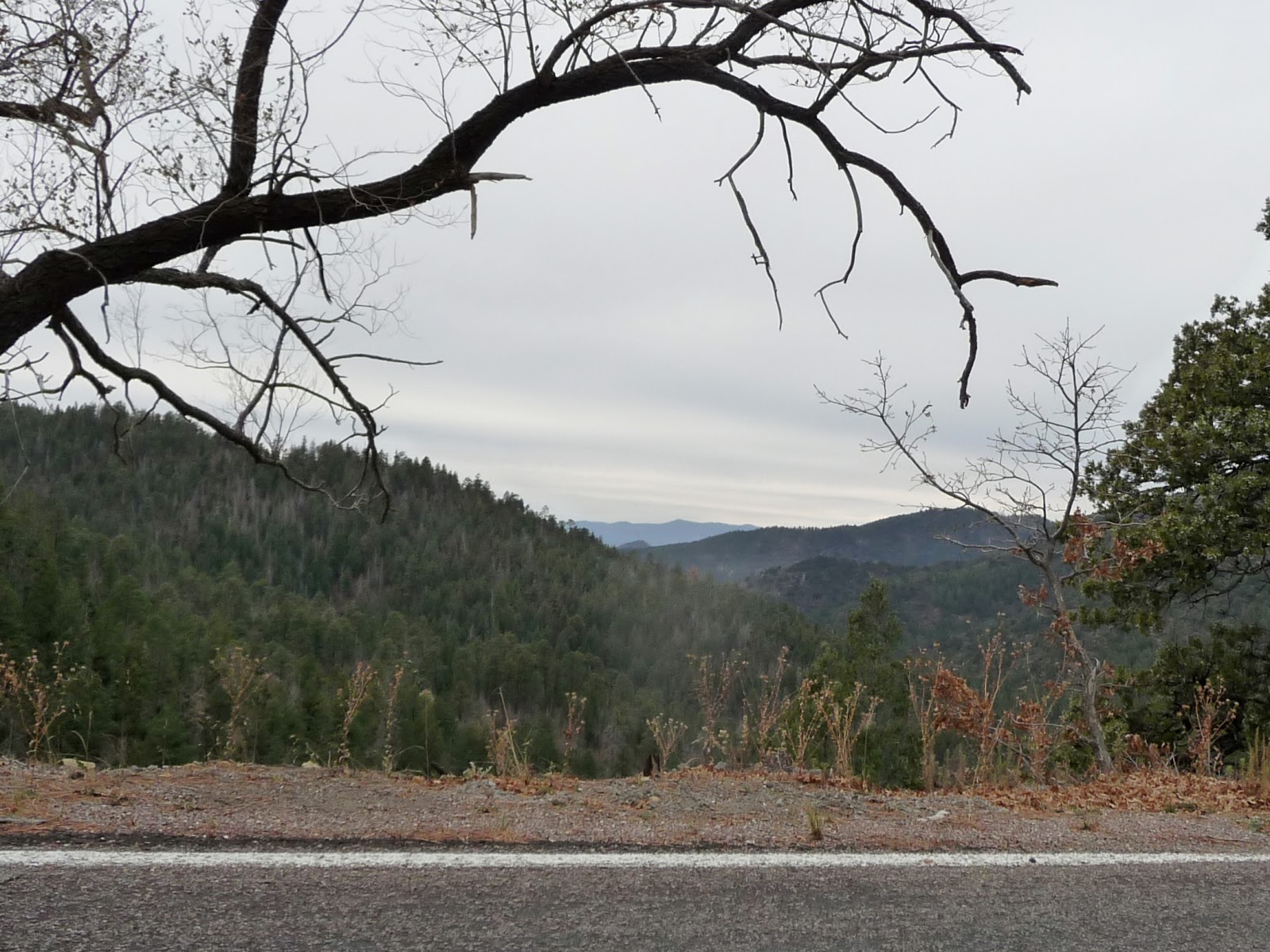
Photo- Oh the amazing view between the trees as you get closer to the top!

Soon, the road widened and I was at a junction with Hwy 180.  I turned right towards Sliver City.  As I am traveling along on the south side of the road are carved mountains with all kinds of copper and rust colors.  It looks like a mine.  Off on the left I see a viewing area for the mine and I pull into it.  It’s the Santa Rita Copper Mine which claims it is the oldest operating mine in the country.  It’s a pretty good sized hole in the ground and I wonder how it compares with the Kennecott Copper Mine just outside of Salt Lake City.  I took a couple of pictures while 4 older guys there standing looking and talking together; the women are sitting in the cars.
Photo- The Santa Rosa Mine the oldest operating mine in the US.

I jumped back in the car and continue on to Sliver City.  I follow the signs to the Main Street Historic District.  You know, there seems to be a slight correlation between historic district areas and artists.  Why is that?  Maybe us artists are drawn to them?  I park the car and started to walk along the street.  I get several “HI’s” from what I gather are locals.  Boy, they are a friendly lot here.  I walk down one side to another.  It’s about 4pm and some of the shops are already closed even though by their hours they should be opened.  I went into a couple of shops. 
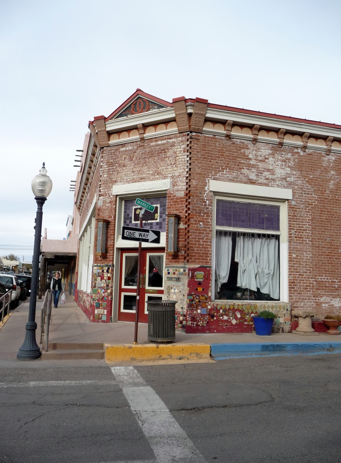
Photos- Older colorful buildings in Sliver City, NM.
 
One shop I went into, I overheard the guy saying on the phone that he can’t close up just yet cuz he has customers.  I went into a jewelry shop with very inexpensive prices.  I couldn’t pass up pairs of earrings for $3 to $5 per pair.  I spent $15 and got 4 pairs of wonderful earrings.  I talked with the clerk and he had moved from California.  He’s semi-retired and just does this to keep himself busy more than anything.  The people are very nice here he said.  I told him about the waving and he said yes that’s the locals.  They are courteous drivers too he said.  I continued on but more and more of the shops were closed.  I went into a textile crafts and art shop.  I talked with the clerk there too.  It was about the same things.  How friendly the people are and that’s why her husband and she moved here.  They were in California.
Photo- Interesting artistic details that they do to the buildings in Sliver City, NM.

I headed back to my car and drove towards Deming where my hotel was for the night.  I watched the flat area between Sliver City and Deming change from dusk to pitch black night.  There wasn’t much out in this area at all.

Wednesday, November 7, 2012

DAY 77- Scottsdale Old Towne & Ghost Towns…

I said goodbye and gave Laura a hug just before she got on the airport shuttle.  It had been a fun weekend but it was time to move on.  Then, I was off in my car.  The plan for the day was a bit of sightseeing in Old Towne Scottsdale and then onto a Ghost Town that I had seen a brochure at the hotel about.  The end of the day I had a hotel room in Payson, AZ.
Photo- Some of the signage for Old Town in Scottsdale.

I tried to follow my directions to Scottsdale Old Towne but one of the Google instructions had said stay to the right when it should have said stay to the left.  I ended up doing a big circle of exits with the freeway to drive by again and stay in the left this time.  Then, I was back on track and located the Scottsdale Old Towne.
Photos- Sculptures in and around Old Town Scottsdale area.


Scottsdale Old Town has a LOT of galleries and jewelry places.  I walked around for almost a whole hour just sightseeing the galleries.  There was quite a few sculptures in the area and then I happened to wonder into a few jewelry places.  BUT I was good and didn’t purchase any jewelry.  I’ll tell you it wasn’t easy because there was so much variety and 90% of it was sliver which comes in handy when you are allergic to gold.  I did however break down and purchase a new handbag.  One of the tote bags I had been using sprung a hole in the bottom in the last two days and THAT’s not good to have.
Photo- The Mission Church on the edge of Old Town Scottsdale.

I visited the Adobe Mission Church that was on the edge of the Scottsdale Old Towne.  I mostly did a self-guided tour; though, one of the gals that were inside walked me through ¾ of the church telling and showing me things.  The church had been built in 1933 by the Mexican farm workers in the area.  The closest church prior to that was St. Mary’s in Phoenix.  I watched a video in the sacristy area and signed the visitor’s book.  The last two visitors were also from Utah; which I found rather funny—one from St. George and the other from Provo.  We live in such a small world or it seems sometimes.

I checked out several restaurants in the area and had been told to visit one that I later found out had been closed for almost 2 years.  I finally decided to eat at a place called Ciene Agaves which had a fun cool interior away from the sun that was really starting to warm up the day.  I had a couple of tacos and the spicy island shrimp tacos were wonderful.  Next, I figured I had better get going out to the ghost town which was at least 40 miles away.

Photo- The Saloon at Goldfield Ghost Town.
I had read about the Goldfield Ghost Town in a brochure that I had found at the hotel in Phoenix.  Let me just say this—don’t always believe what you read in the brochures.  In general, I found this Ghost town to be a bit of a disappointment but then again anything like this would have been a bit of a downer after spending a day in Tombstone.  So I’m going to say that the jury’s kind of out on this one.  Though, I will say that the view of the Superstitious Mountains nearby made it worth the drive out there.
Photo- Goldfield Ghost Town with Superstitious Mountains in background.

Goldfield Ghost Town was a picture opportunity and I took the train ride around the town.  You really had to listen to the train conductor on the ride around perimeter of the ghost town.  It was a little like listening to the Swedish cooking guy on the Muppets.  The conductor had a bit of an accent.  The train also never got above 5mph and I was hoping for a bit of a breeze to cool off with.  I went in several stores afterwards but there wasn’t much in all to do in the area but walk around town and shop.  Anyway, that was my experience.

Needless to say I didn’t spend very long at the Ghost Town and before long I was driving towards Payson where I would spend the night.  I went through Usery Pass and it was a very scenic area where there were quite a few cyclists in the area.  If I didn’t have an almost 3 hour drive I would have joined them.  But what I got a kick out of most in this area was this HUGE Phoenix painted in white with an arrow on the side of a mountain as I drove through the pass.  It was like a HUGE sign saying dummy Phoenix is this way!  No need for GPS or Google for this one.
Photo- Now which way was Phoenix?

I drove north through Tonto National Forest.  The area was beautiful with tall cactus and scrub brush but then it changed and there was more trees as you progressed north.  I went by a lake that was an amazing blue against the landscape.  The landscape got even more pretty and mountainous the further north you went.  I was having a hard time concentrating on the road because I was looking all over the place as I drove.  I slowed down a bit and put the cruise on and just took my time. 
Photos- Pretty scenery as I drove north on Hwy 87.


Before I knew it I was in Payson.  I saw a sign for a Zane Gray cabin and museum but it was after 5pm and would be getting dark soon.  So I went to check into the hotel for the night.  I asked the desk clerk where would be a good place to eat and without hesitation she told me about the Buffalo Bar & Grill that was two doors down.  She said it was the best place to eat in town.  I threw on a jeans and a jacket.  It was getting to be chilly especially as the sun went down, but Payson is at about 5400 ft. so that should be expected this time of year.  I walked down to the Buffalo Bar & Grill with its rustic wooden atmosphere.  I had a chili burger with yummy sweet potato fries and a beer while I watched the first half of the Monday Night Football Game.

Thursday, October 25, 2012

DAY 65- Prescott, Sedona, to Flagstaff…

I woke up to a wonderful sunrise outside my window of my east facing room.  I went down for the continental breakfast.  I had stayed the night in a very nice Hampton Inn in Prescott Valley.  They have fresh coffee out all night for you to partake of which I thought was a wonderful feature considering how I love my coffee.

I went back up to my room jumped on my computer and let’s see where we are going to go today.  I had the idea of going into Prescott again just to check out the area for a bit then I wanted to head north to Sedona and possibly stay in Flagstaff for the night.  My thought was that Flagstaff hotels would be cheaper than Sedona.  As I got on-line with my computer that just what I found out.  Set up my reservation packed and off I went.
Photo- Prescott's Courthouse Square a very walkable park like setting.

Back into Prescott I drove.  Prescott is nestled in foothills and mountain valleys.  It is a very pretty area.  There’s nice neighborhoods that looked average income but were well kept near the historic  downtown.  I parked on the street next to the courthouse square.  Prescott’s historic downtown is centered off of the Courthouse square.  I noticed signs under light poles that stated” Prescott Everyone’s Hometown”.  I will admit that Prescott did have a nice comfortable feel to it.   
Photo- Signs stating Prescott Everyone's Hometown.

On one side of the Courthouse Square there’s a grouping of older buildings called Whiskey Row which has a variety of shops, restaurants, and bars.  The art collective that I visited last night is here.  Almost down at the other end, I visited another gallery call Van Gogh’s Ear.  Yes, I’ll admit I went in because of the name but it was a very nice gallery with a wide variety of art; paintings, photography, sculpture, jewelry, purses, and other wearable art.  I also loved that they were playing soft jazz music. 
Photo- Part of Prescott's Whiskey Row.

I walked around the rest of the street area surrounding the courthouse square.  There were quite a few western wear or art shops but among those were woman’s upscale boutique clothing stores and antique shops.  It was an understated easy going shopper’s paradise in one aspect but I was really enjoying walking around and window shopping because real effort had been put into the window displays.  I bet this place would be amazing at Christmas.

I looked at the clock and realized I had better get going to Sedona or I would really be driving in the dark to Flagstaff. I took a chance that Hwy 89 would run into Hwy89A.  I had a general map but it didn’t show the city area of Prescott and where the highways met up.  As I headed north out of Prescott the landscape changed dramatically from mountain valley to sandy rock formations.  This was very interesting and within such a short distance.  Wow!  I wish I had known and made more time.  I think I may have to come back here to explore more in the future.  But I will admit that I’ve felt that way in several areas.  I often feel I could spend weeks or years exploring some of these places that I have visited.
Photo- A rocky landscape just north of Prescott.

Photo- Scenery along Hwy 89A north before Jerome.
The scenery as I headed north became amazing the further I went north and the closer I got to Sedona.  Warning Hwy 89A is one of those scenic routes which entail tons of curves but the curves are really worth it in this case.  Course, I think I’ve heard men say that too.  Hmmm.   The road runs through a mountain pass and there are rocks, evergreen trees, and the other trees were turning yellow and orange.  It was gorgeous scenery.  I stopped at a view area just before coming into the town of Jerome.
Photo- View Area just before Jerome.

Jerome is a ghost town that has turned into an artist haven.  I was here years ago with a friend and it was marvelous place to spend the day.  The highlights I can remember of that day is eating a hamburger at the haunted hotel and watching a glass blowing demo in a lawn chair from 4 ft. away.  I was there to late in the day to find a parking place easily and I really wanted to spend time in Sedona.  I drove through Jerome slowly remembering some places and seeing new places too.
Photo- Red rock scenery just outside of Sedona.

I was several miles away from Sedona when I started to see the red topped bluffs that surround the area.  I was just barely within the town area when I saw these pink jeeps turning down a side street.  I HAD to check this out.  The side of the jeeps stated that they were off-road tours and they were packed with people.  I followed two of the vehicles and there was another two behind me.  I figured I would follow until they went off the road and get a taste of what the riders get.  I was on Dry Creek Road and it was a nice drive out on the road.  I completely lost interest in the pink jeeps and was enamored with the scenery. WOW!  The road came to a “T” and I took a right hand turn.  I stopped at a parking place not far down the road and took a few pictures. 


I turned around and headed back to Sedona.  I saw signs for a visitor’s center and followed those.  I went in and asked one of the older men at the busy counter if there was a shopping area with a lot of galleries and some restaurants too.  He grabbed a map and told me of two that were very close. 

I went to the Tlaquepaque; no please don’t ask me to pronounce this name out loud.  Parking was a bit of a struggle but it ended up really being worth it.  I walked from the boondocks and into a Mexican Oasis.  Among the Spanish inspired architecture there were graceful arches, the soft splashing of fountains, tranquil plaza areas, and shade covered verandas.  It was all very relaxing and there are about 45 restaurants and shops spread throughout the area. 
Photos- The Tlaquepaque shopping area in Sedona.


There were live musicians playing out in a couple of the plaza areas.  One was a new age on an electric guitar that I didn’t care for but another was playing soft flamenco guitar which just fit in perfect with the architecture.  He had CD’s that were available to purchase.  I sat down and listened for a while on a nearby bench; watching people walk by and shopping.  I just sat and enjoyed this was a wonderful place to come.  It was also rather confusing to find your way around because there are so many nestled verandas and plaza areas of all sizes. 

Most of the shops were galleries, but there were a few restaurants, pottery, clothing, and what not among them too.  I ended up having a late lunch on an outside patio of a Mexican restaurant called El Rincon which had bright colored umbrella tables. The food was okay but it was on the bland for Mexican but it was a mostly white high end clientele in the area.  But a warning if you do purchase or eat anything in Sedona, you need to figure in their 10.75% sales tax.  I overheard one lady complaining about it when she purchased an item that was under $5 at one store with the clerk.

Next I drove further north on Hwy 89A, the highway went by state parks and recreational areas.  I was really enjoying the drive and enjoying the scenery of rock formations, evergreen trees and colored leaves.  About 10 miles out of town, I look down to see the fuel light has come on.  Oh shit!  I should’ve fueled up when I was in Sedona; what was I thinking?  I had gotten a little too relaxed at the Tlaquepaque.  I pulled into the next turn out area, turned off the car, and grabbed the map to see where I was.  Well, I could be anywhere along a 27 mile stretch and not particularly sure if there would be a fuel station at the end of that stretch.  I opted to turn around back into Sedona and hoped that the downhill would help get better gas mileage to get me further.  I thankfully made it to the first gas station and filled up. 

It was getting later and I thought it might be faster to work my way over to I-17 to head north to Flagstaff.  I turned onto Hwy 179 heading south.  It was the only way to get to I-17 from Sedona.  Well, I don’t know if it was any faster to go this way because every 4th intersection was a round-about where you had to slow to 15mph.  They sure love their round-abouts!  There wasn’t as many as Bend, OR but this area from Sedona heading over towards Cottonwood sure had them.  Just before Cottonwood the road finally straightened out and widened.  The speed limit increased and I felt like I finally arrived at I-17.  I turned north to Flagstaff.

The interstate was virtually a straight shot going north but had a fair amount of climbing.  I took it easy.  The car has been fine but I didn’t want to push it.  The interstate speed was 75 but I stuck to about 70mph.  Now the only problem is that I had directions to the hotel from Hwy 89A.  But I did have a Woodlands Blvd that was supposed to be a turn off.  I take an exit off to double check the address and directions.  As I’m trying to get back onto the interstate I stumble upon Woodlands Blvd.  What luck!

I drive along and look for the hotel.  I turn in and park.  I wait while the clerk checks in two married couples.  I get up there and tell him I’m here to check in.  I give him my name, and he asks how to spell it.  Just like it sounds—All Good, I say.  He checks his computer and asks if the reservation maybe under another name.  No, I say.  Is there another Radisson in the area?  Mamm, this is Ramada.  The Radisson is down the street and off on your right.  I turn around and laughingly announced to the whole room,” Go figure!  I got the wrong hotel!”   Out the door I went, while the perplexed faces of the other hotel guests looked on.

I found the Radisson and I was so glad to see it because this was definitely a step up from the Ramada down the street.  I went into a marbled entrance and up to the desk where a clerk helped me right away.  He was happy because I guess my reservation was the only one that had gone smoothly for him for the night.  He said I was his lucky one and upgraded me to a suite.  Sweet!  While he finished checking me in I told him about checking in at the Ramada down the street.  He said that happened all the time.  They used to have a Residence Inn down the street that they used to get people trying to check in here too.  He was probably just being nice but I was feeling rather like a blond.

I got to the room and changed into some warmer clothes.  The temperature overnight in Flagstaff was supposed to get down to 42 degrees.  Brrr-rrr!  Man, I’m turning into a whimp!  I decided to just take it easy and stay in the hotel to eat.  I went into the Lounge area where there was only one other couple.  They had the game of the first World Series on and I sat at the bar ordered an appetizer from the Happy Hour Menu and had a bottle of Blue Moon.  It was myself and the bartender watching the game alone for the most part.  We would make comments about the game here and there but neither one of us were really vested in it.  He was a Diamond Back fan and I’m a Braves fan; but we still watched the Giants win the game.

Monday, October 8, 2012

DAY 47- Mountain Passes and Gold Rush Territory

I was going to treat myself to a real breakfast at a local restaurant in South Tahoe Lake.  The Red Hut had come highly recommended but when I arrived at 9am there was a line out the door.  Nope that was too long of a wait for me.  I turned back to my car and decided I would make do with a granola bar instead.  Today’s plan was to drive from Lake Tahoe to just outside of Yosemite National Park.  It was at least a 4.5 to 5 hour drive.  I needed to get on the road.
Photo- Some wonderful Fall color as I came down out of Luther's Pass.

I drove south hooking up with Hwy 89 going up and over Luther Pass then down into a valley with some wonderful fall foliage color.  Cars were stopping at the sides of the road to take pictures.  It was pretty.  Next, I turned onto Hwy 89 and went up and over Kit Carson Pass.  Yes, you probably recognize that famous name.  This was a pass that Kit Carson used to get through the area.  This pass was amazing with rock formations and lake overlooks.  I stopped real quickly a couple of times to take photos.    
Photo- Red Lake as seen from Kit Carson Pass.

I was heading into the middle of Gold Rush territory.  There were museums and old town areas that were dedicated to the Gold Rush history which occurred from the late 1840’s through to the mid- 1850’s.  I would drive through towns where the main streets look like most of the buildings were from that era of time.  Street names had the word gold or mine or strike in them.  A couple of the towns were even having history festivals.  Unfortunately, I had already reserved the night at a hotel near the south entrance to Yosemite or I would have stayed and checked out the area more.
Photo-  The yellow building of Thomi's where I
enjoyed a wonderful cranberry chicken salad sandwich.

I stopped for lunch at a cute restaurant in Jackson just after turning onto Hwy 49.  Another name for Hwy 49 is the Golden Chain Highway.  This is because this road connects a great deal of the gold rush mining communities together.  There is however one gold mine that still produces a great deal in the area and you go right by its gated entrance.  You can also see the carved hills above the gate but it’s kind of keeps a low key appearance. 

Photo- Abandoned old buildings are a common sight in the Gold Rush area.

Highway 49 curved a great deal and went through more of the Gold Rush Towns.  Quite often the traffic would slow down as it went through these towns; sometimes to a standstill as tourists and visitor’s traffic clogged up the area.  The drive was taking longer than what I had anticipated.
Photo- A church that I thought was interesting with a historical marker
which are common along Hwy 49's Gold Rush route.

I finally arrived at Oakhurst and got checked in.  Earlier when I went through town I had seen a Mexican restaurant that appeared busy and I thought that was a good sign.  Yep!  That thought definitely paid off.  I relaxed with a blended margarita and enjoyed a fabulous chimichanga with rice and beans.  This chimichanga was unlike any I had ever had.  It was like a lovely flakey pastry shell on the outside with wonderful chunky homemade chili Verde inside.  Yummy!  I had a Mexican coffee for dessert and then I was ready to call it a night.